Get that out right now!!

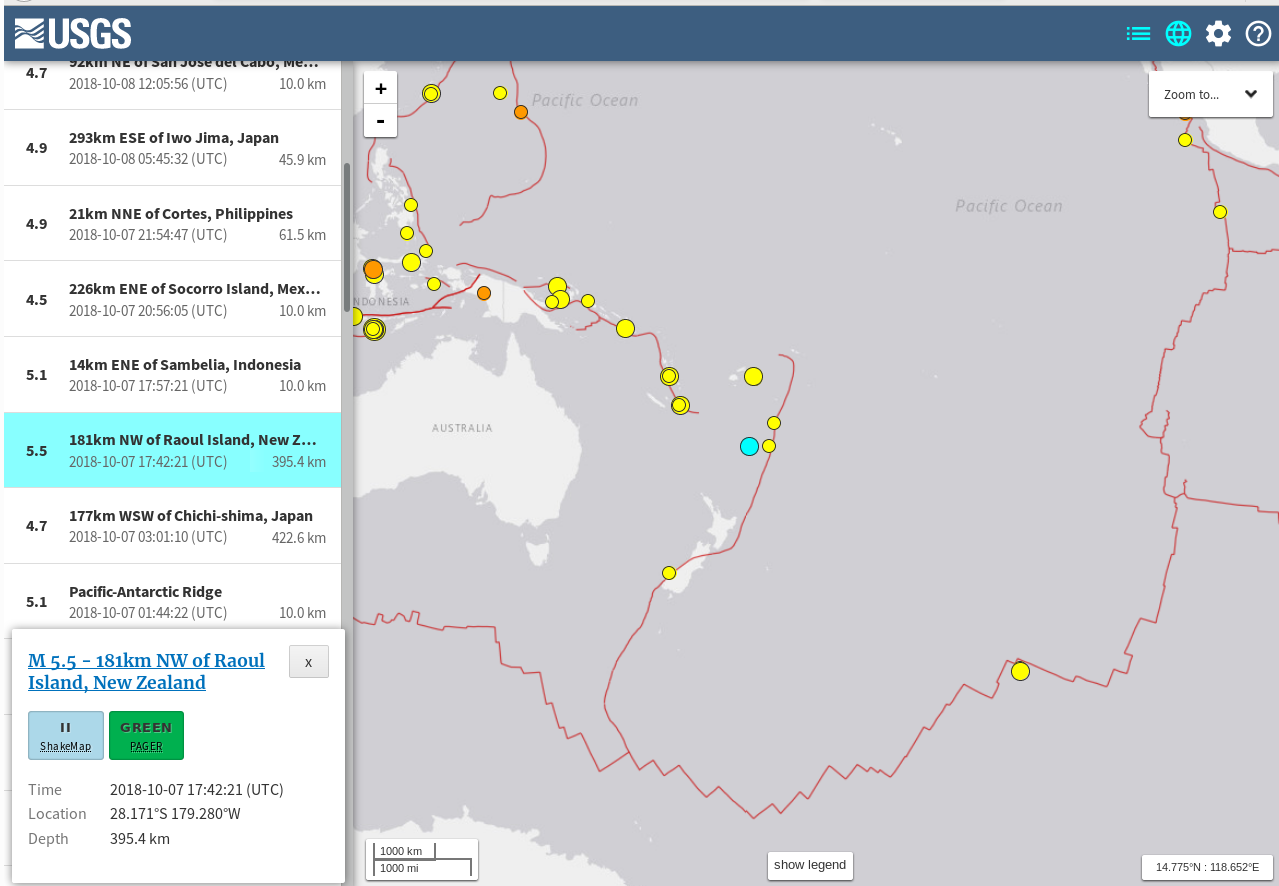
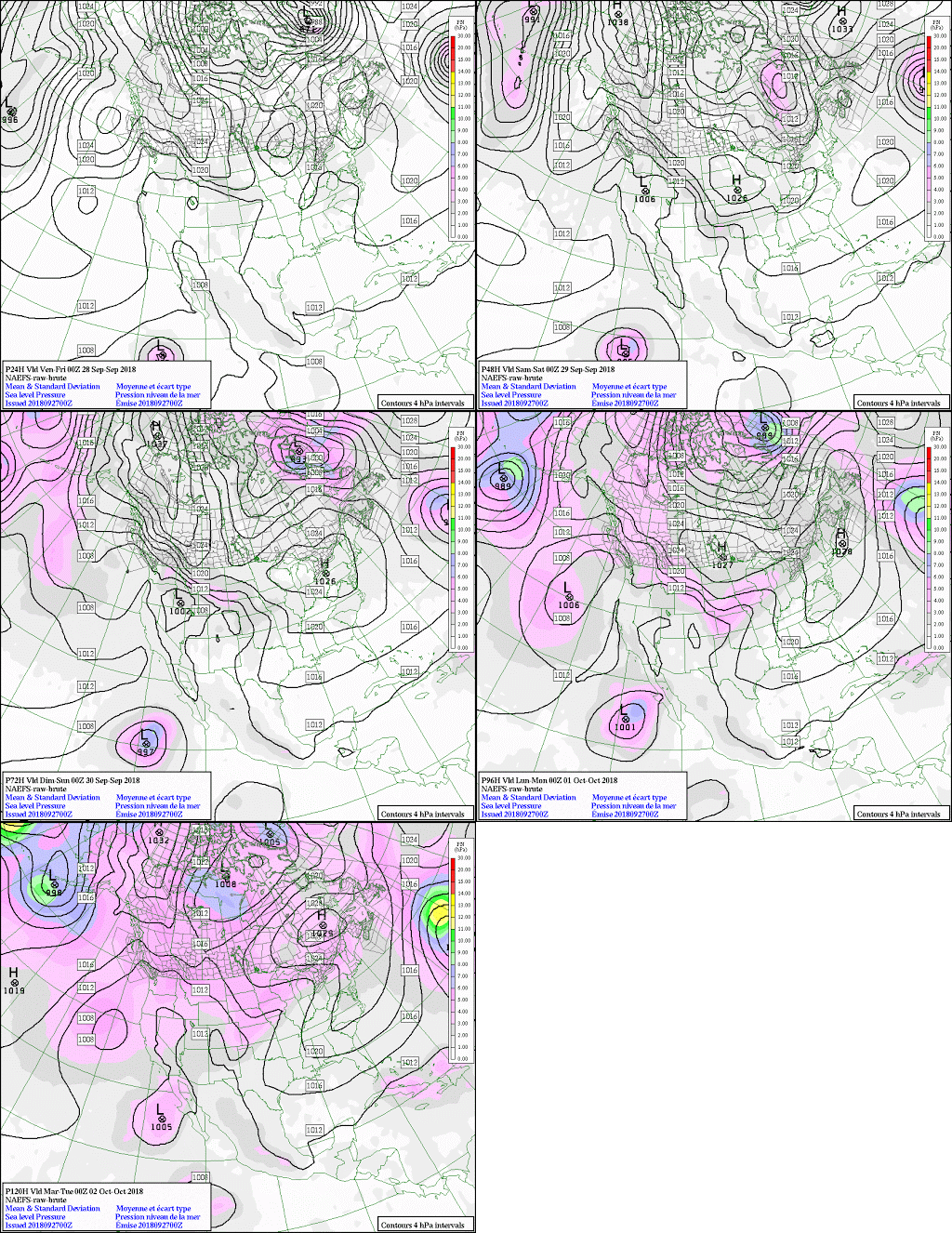
The next big one is on the NAEFS for 5 days time, the 16th:

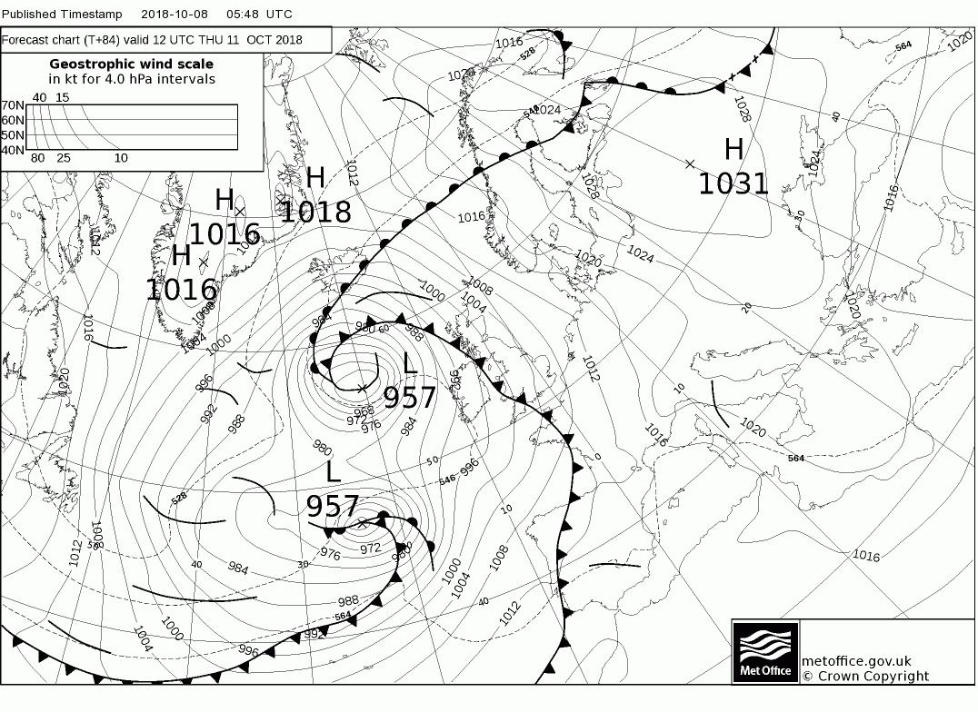
Ergo it is on the t+120 of the North Atlantic too:

No it is on the board but that is the wrong day

Tonight first, a forecast clears the butterfly effect from the models before we see the next one clearly enough. Odd how that works!
https://earth.nullschool.net/#current/wind/surface/level/orthographic=-26.50,52.98,289

Wow!
Watch this:

54 words


Keep On The Watch! – Daily Table: 20181003

What quakes happened after the last Atlantic storm?

Date Time Region Mg Atlantic Storm 2018 Status Volcano
2018-10-02   10:08:46.0 VANUATU 5.6 Hurricane Leslie remains nearly stationary Mount Soputan, Central Indonesia
2018-10-01   23:59:40.1 SUMBA REGION, INDONESIA 6.0
2018-09-30   10:52:22.6 FIJI REGION 6.6
2018-09-28   13:35:30.3 MINAHASA, SULAWESI, INDONESIA 5.7
2018-09-28   10:50:24.8 5.7
2018-09-28   10:25:04.2 5.8
2018-09-28   10:16:48.6 5.7
2018-09-28   10:14:20.0 5.8
2018-09-28   10:02:44.3
7.4
2018-09-28   07:00:02.1 MINAHASA, SULAWESI, INDONESIA 6.1
Leslie Tropical Rainstorm

Data taken from:

Microwave

Electromagnetic spectrum

Microwaves occupy a place in the electromagnetic spectrum with frequency above ordinary radio waves, and below infrared light:

Electromagnetic spectrum
Name Wavelength Frequency (Hz) Photon energy (eV)
Gamma ray < 0.02 nm > 15 EHz > 62.1 keV
X-ray 0.01 nm – 10 nm 30 EHz – 30 PHz 124 keV – 124 eV
Ultraviolet 10 nm – 400 nm 30 PHz – 750 THz 124 eV – 3 eV
Visible light 390 nm – 750 nm 770 THz – 400 THz 3.2 eV – 1.7 eV
Infrared 750 nm – 1 mm 400 THz – 300 GHz 1.7 eV – 1.24 meV
Microwave 1 mm – 1 m 300 GHz – 300 MHz 1.24 meV – 1.24 µeV
Radio 1 mm – 100 km 300 GHz – 3 kHz 1.24 µeV – 12.4 feV

In descriptions of the electromagnetic spectrum, some sources classify microwaves as radio waves, a subset of the radio wave band; while others classify microwaves and radio waves as distinct types of radiation. This is an arbitrary distinction.


Taken from:

https://en.wikipedia.org/wiki/Microwave

Keep On The Watch! – Daily Table: 20180928

What quakes happened before the last Atlantic storms?

Date Time Region Mg Atlantic Storm 2018 Status
2018-09-28   13:35:30.3 MINAHASA, SULAWESI, INDONESIA 5.7
2018-09-28   12:32:45.0 MARTINIQUE REGION, WINDWARD ISL. 5.5
2018-09-28   10:50:24.8 5.7
2018-09-28   10:25:04.2 5.8
2018-09-28   10:16:48.6 5.7
2018-09-28   10:14:20.0 5.8
2018-09-28   10:02:44.3
7.4
2018-09-28   07:00:02.1 MINAHASA, SULAWESI, INDONESIA 6.1
Leslie Tropical Rainstorm
Kirk Tropical Storm


Data taken from:

Keep On The Watch! – Daily Table: 20180927

What quakes happened before the last Atlantic storms?

Date Time Region Mg Atlantic Storm 2018 Status
2018-09-27   22:25:44.2   FIJI REGION 5.5
2018-09-27   10:25:47.2
EAST OF SOUTH SANDWICH ISLANDS 5.7
2018-09-26   00:37:32.5   FIJI REGION 5.7
Leslie Tropical Rainstorm
Kirk Tropical Storm

Data taken from:

¿Intervenidos o qué?

Está nublado pero con resolana suficiente. No es un día soleado pero aún así tenemos resplandor suficiente.

La novedad es lo lento que está la red móvil. Aunque H, no es suficiente para abrir ciertas páginas. Veamos cómo se comporta en el resto del día.

New Category: daily_report/reporte_diario
Me tocó hacerlo manual, porque lo lento de la red no permite agregar la categoría por los momentos.

Y quedaremos como Bosquejo/Draft sólamente porque no me permite publicar!!!!

See If You Can Find

What quakes happened before the last Atlantic storms?

Systems


2018 Earthquake 2018 Atlantic Storm
EQ Mag Storm Status
Leslie SubTropical Storm
Tropical Rainstorm
Kirk  (Sep 22) Tropical Storm
GALAPAGOS ISLANDS REGION 2018-09-21 12:49:28.1 5.7
FIJI REGION 2018-09-21 03:41:41.9 5.9
 FIJI 2018-09-21 03:40:39.1 5.8
CARLSBERG RIDGE 2018-09-19 08:53:13.6 UTC 5.4
2018-09-18 11:57:51.9 UTC 5.8
SOUTHWEST INDIAN RIDGE 2018-09-18 07:27:40.9 UTC 6.0
CRETE, GREECE 2018-09-17 00:24:07.7 UTC 5.0
South of the Fiji Islands 2018-09-16 21:11:48 UTC 6.6
7km NE of Sapatgram, India 2018-09-12 04:50:46 UTC 5.3 Joyce (21:00 UTC on Sep 12) Tropical Storm
202km WNW of Ile Hunter, New Caledonia 2018-09-10 19:31:37 UTC 6.3
61km SW of L’Esperance Rock, New Zealand 2018-09-10 04:19:02 UTC 6.9
65km NW of Kirakira, Solomon Islands 2018-09-09 19:31:34 UTC 6.5
18km WSW of Lianzhu, China 2018-09-08 02:31:31 UTC 5.6 Helene Hurricane
Isaac  (Sep 8) Hurricane
17km SSW of Alausi, Ecuador 2018-09-07 02:12:04 UTC 6.2
102km ESE of Suva, Fiji 2018-09-06 15:49:18 UTC 7.9
27km E of Tomakomai, Japan 2018-09-05 18:07:58 UTC 6.6
Gordon (Sep 3) TS
Florence (Sep 1) Hurricane
209km W of Ile Hunter, New Caledonia 2018-08-29 03:51:56 UTC 7.1
134km ENE of Anatahan, Northern Mariana Islands 2018-08-28 22:35:13 UTC 6.4
32km SW of Javanrud, Iran

2018-08-25 22:13:25 UTC
6.0
138km WNW of Iberia, Peru

2018-08-24 09:04:06 UTC
7.1
14km NW of Yaguaraparo, Venezuela

2018-08-22 13:27:48 UTC
5.8
2018-08-22 09:31:47 UTC
6.2
2018-08-21 22:32:26 UTC
6.5
2018-08-21 21:31:47 UTC
7.3
2018-08-19 14:56:28 UTC
6.9
2018-08-19 04:28:58 UTC 6.8
2018-08-19 04:10:23 UTC
6.3
2018-08-19 00:23:06 UTC
6.3
2018-08-19 00:19:40 UTC
8.2
2018-08-17 23:22:24 UTC
6.1
107km NNW of Nggilat, Indonesia

2018-08-17 15:35:01 UTC
6.5
2018-08-16 18:22:53 UTC
6.3
2018-08-15 21:56:54 UTC
6.6
2018-08-15 01:24:26 UTC
4.4
Ernesto  (At 15:00 UTC on Aug 15) Tropical Storm
2018-08-12 14:58:54 UTC
6.3
5km W of Santong, Indonesia 2018-08-09 05:25:31 UTC 5.9

List of Earthquakes

https://earthquake.usgs.gov/earthquakes/browse/significant.php

Storms

https://www.wunderground.com/hurricane/atlantic/2018/tropical-storm-isaac

2018 Atlantic hurricane season

https://en.wikipedia.org/wiki/2018_Atlantic_hurricane_season