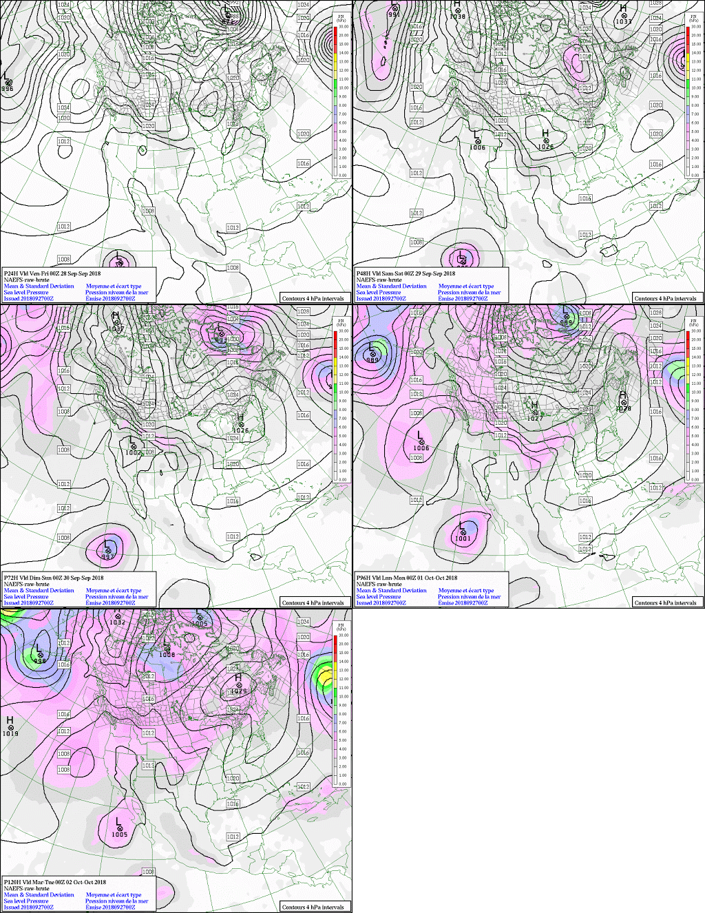
Some Basic from 19 October 2018

Look at the Original Post at https://weathercharts.wordpress.com/2018/10/20/19-october-2018/
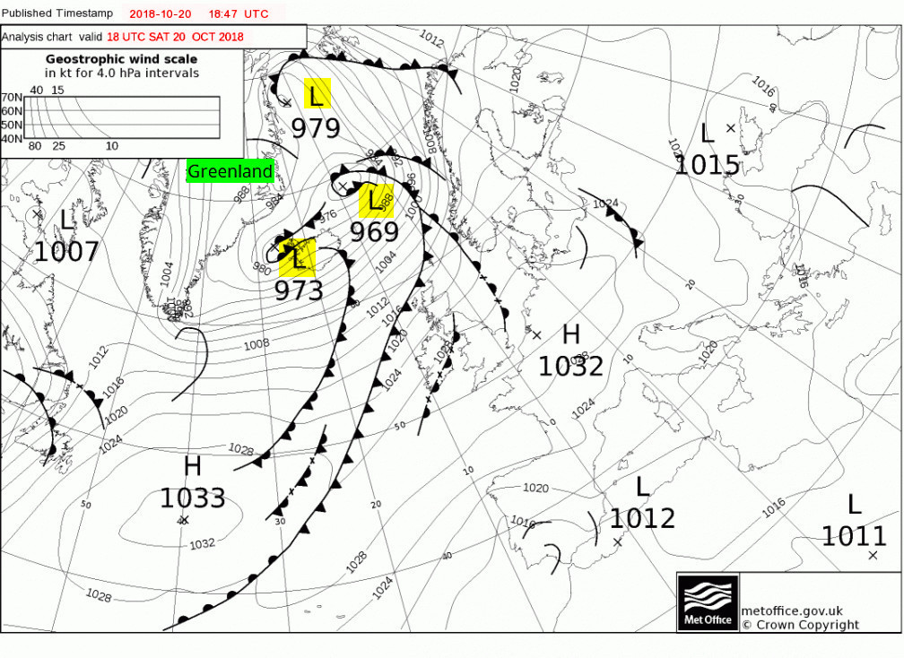
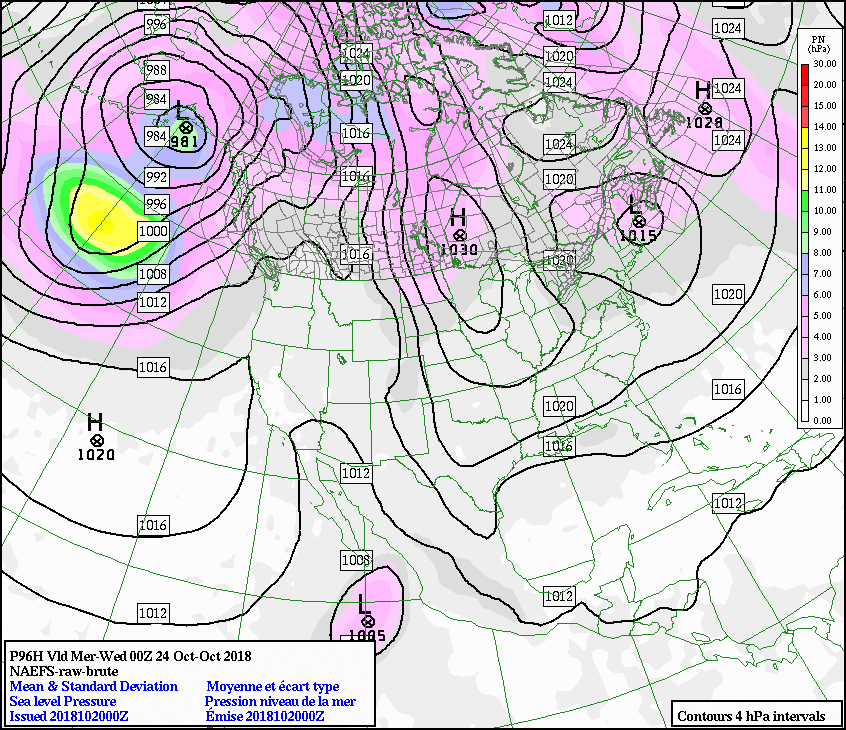
18:00 on the 20th Note the three cyclones on the east of Greenland and the breaking cold front of an occlusion….
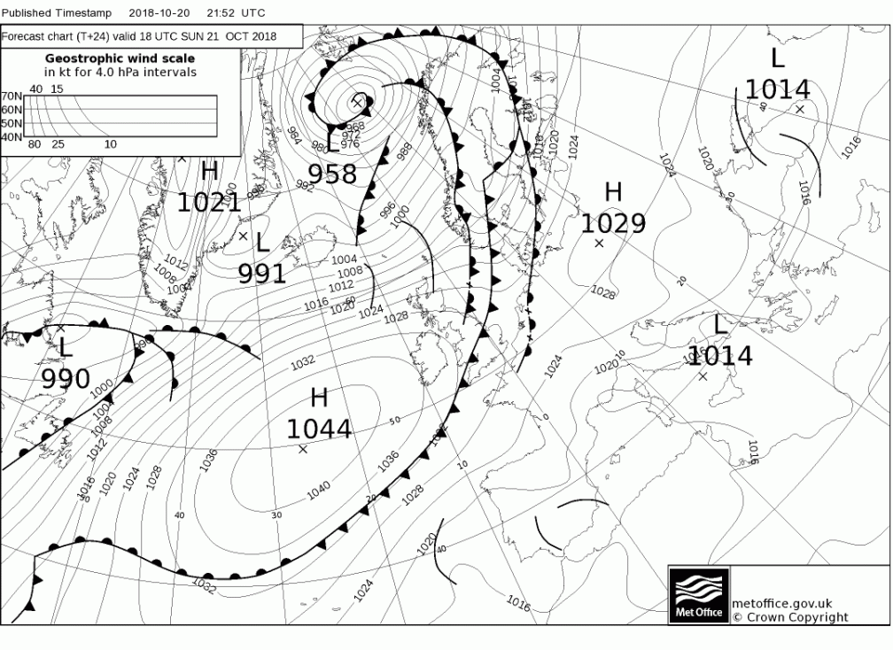
24

Followed by the sudden appearance of the huge unnatural Anticyclone. OK, maybe not that huge but it isn’t the minuscule dotted series it should be, either.

Follow these North Americanos for when the large earthquake heralds th eruption because…
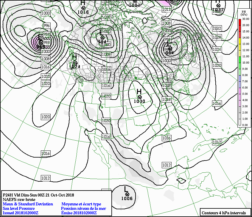
2018102000_024

Three adjacent Lows show that the eruption will be running from this date.
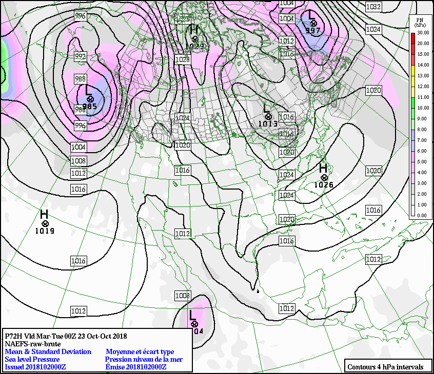
2018102000_072

After the large eruption that is.

2018102000_096

What am I talking about the three Anticyclone I mean, do I?
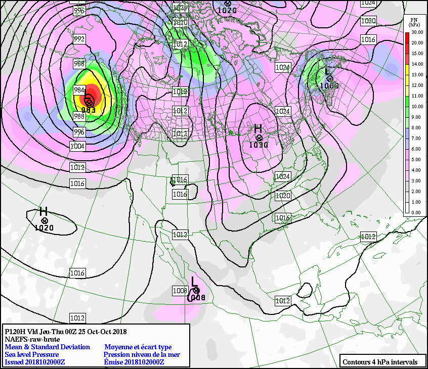
2018102000_120

It is all very odd are we to expect another magnitude 7+ or some such?
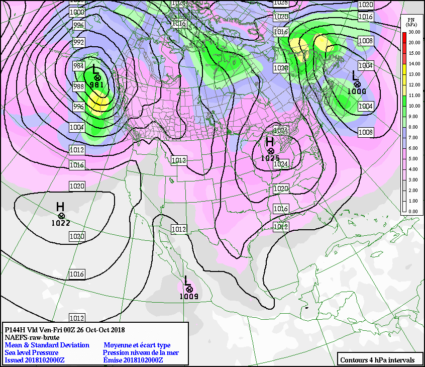
2018102000_144

I think the NAEFS is being stifled from giving us the correction due to the Canadians trying to hide an Huchison Effect as a Butterfly Effect

Get that out right now!!

The next big one is on the NAEFS for 5 days time, the 16th:

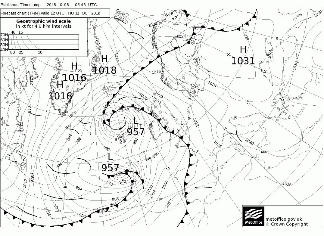
Ergo it is on the t+120 of the North Atlantic too:

No it is on the board but that is the wrong day

Tonight first, a forecast clears the butterfly effect from the models before we see the next one clearly enough. Odd how that works!
https://earth.nullschool.net/#current/wind/surface/level/orthographic=-26.50,52.98,289

Wow!
Watch this:

54 words


Keep On The Watch! – Daily Table: 20181003

What quakes happened after the last Atlantic storm?

Date Time Region Mg Atlantic Storm 2018 Status Volcano
2018-10-02   10:08:46.0 VANUATU 5.6 Hurricane Leslie remains nearly stationary Mount Soputan, Central Indonesia
2018-10-01   23:59:40.1 SUMBA REGION, INDONESIA 6.0
2018-09-30   10:52:22.6 FIJI REGION 6.6
2018-09-28   13:35:30.3 MINAHASA, SULAWESI, INDONESIA 5.7
2018-09-28   10:50:24.8 5.7
2018-09-28   10:25:04.2 5.8
2018-09-28   10:16:48.6 5.7
2018-09-28   10:14:20.0 5.8
2018-09-28   10:02:44.3
7.4
2018-09-28   07:00:02.1 MINAHASA, SULAWESI, INDONESIA 6.1
Leslie Tropical Rainstorm

Data taken from:

Keep On The Watch! – Daily Table: 20180928

What quakes happened before the last Atlantic storms?

Date Time Region Mg Atlantic Storm 2018 Status
2018-09-28   13:35:30.3 MINAHASA, SULAWESI, INDONESIA 5.7
2018-09-28   12:32:45.0 MARTINIQUE REGION, WINDWARD ISL. 5.5
2018-09-28   10:50:24.8 5.7
2018-09-28   10:25:04.2 5.8
2018-09-28   10:16:48.6 5.7
2018-09-28   10:14:20.0 5.8
2018-09-28   10:02:44.3
7.4
2018-09-28   07:00:02.1 MINAHASA, SULAWESI, INDONESIA 6.1
Leslie Tropical Rainstorm
Kirk Tropical Storm


Data taken from:

Keep On The Watch! – Daily Table: 20180927

What quakes happened before the last Atlantic storms?

Date Time Region Mg Atlantic Storm 2018 Status
2018-09-27   22:25:44.2   FIJI REGION 5.5
2018-09-27   10:25:47.2
EAST OF SOUTH SANDWICH ISLANDS 5.7
2018-09-26   00:37:32.5   FIJI REGION 5.7
Leslie Tropical Rainstorm
Kirk Tropical Storm

Data taken from:

See If You Can Find

What quakes happened before the last Atlantic storms?

Systems


2018 Earthquake 2018 Atlantic Storm
EQ Mag Storm Status
Leslie SubTropical Storm
Tropical Rainstorm
Kirk  (Sep 22) Tropical Storm
GALAPAGOS ISLANDS REGION 2018-09-21 12:49:28.1 5.7
FIJI REGION 2018-09-21 03:41:41.9 5.9
 FIJI 2018-09-21 03:40:39.1 5.8
CARLSBERG RIDGE 2018-09-19 08:53:13.6 UTC 5.4
2018-09-18 11:57:51.9 UTC 5.8
SOUTHWEST INDIAN RIDGE 2018-09-18 07:27:40.9 UTC 6.0
CRETE, GREECE 2018-09-17 00:24:07.7 UTC 5.0
South of the Fiji Islands 2018-09-16 21:11:48 UTC 6.6
7km NE of Sapatgram, India 2018-09-12 04:50:46 UTC 5.3 Joyce (21:00 UTC on Sep 12) Tropical Storm
202km WNW of Ile Hunter, New Caledonia 2018-09-10 19:31:37 UTC 6.3
61km SW of L’Esperance Rock, New Zealand 2018-09-10 04:19:02 UTC 6.9
65km NW of Kirakira, Solomon Islands 2018-09-09 19:31:34 UTC 6.5
18km WSW of Lianzhu, China 2018-09-08 02:31:31 UTC 5.6 Helene Hurricane
Isaac  (Sep 8) Hurricane
17km SSW of Alausi, Ecuador 2018-09-07 02:12:04 UTC 6.2
102km ESE of Suva, Fiji 2018-09-06 15:49:18 UTC 7.9
27km E of Tomakomai, Japan 2018-09-05 18:07:58 UTC 6.6
Gordon (Sep 3) TS
Florence (Sep 1) Hurricane
209km W of Ile Hunter, New Caledonia 2018-08-29 03:51:56 UTC 7.1
134km ENE of Anatahan, Northern Mariana Islands 2018-08-28 22:35:13 UTC 6.4
32km SW of Javanrud, Iran

2018-08-25 22:13:25 UTC
6.0
138km WNW of Iberia, Peru

2018-08-24 09:04:06 UTC
7.1
14km NW of Yaguaraparo, Venezuela

2018-08-22 13:27:48 UTC
5.8
2018-08-22 09:31:47 UTC
6.2
2018-08-21 22:32:26 UTC
6.5
2018-08-21 21:31:47 UTC
7.3
2018-08-19 14:56:28 UTC
6.9
2018-08-19 04:28:58 UTC 6.8
2018-08-19 04:10:23 UTC
6.3
2018-08-19 00:23:06 UTC
6.3
2018-08-19 00:19:40 UTC
8.2
2018-08-17 23:22:24 UTC
6.1
107km NNW of Nggilat, Indonesia

2018-08-17 15:35:01 UTC
6.5
2018-08-16 18:22:53 UTC
6.3
2018-08-15 21:56:54 UTC
6.6
2018-08-15 01:24:26 UTC
4.4
Ernesto  (At 15:00 UTC on Aug 15) Tropical Storm
2018-08-12 14:58:54 UTC
6.3
5km W of Santong, Indonesia 2018-08-09 05:25:31 UTC 5.9

List of Earthquakes

https://earthquake.usgs.gov/earthquakes/browse/significant.php

Storms

https://www.wunderground.com/hurricane/atlantic/2018/tropical-storm-isaac

2018 Atlantic hurricane season

https://en.wikipedia.org/wiki/2018_Atlantic_hurricane_season

Put that on Qle

Esta es la carta metereológca relacionada con el temblor en Venezuela, mag 7.1 (martes 21 de agosto de 2018, 5:30 pm)

Lots of earthquakes signal their passage by running between to Highs like this

One in the top next to Greenland and one over Germany.

Cold weather coming, I think
Lots of earthquakes signal
I meant to say tornadoes
Lots of tornadoes signal
The weather is not a factor according to them. We know better and it always changes after a large quake.
 There was a nonstop rain after the EQ.

The rain is a tell

 “It was a hard rain, a perpetual rain, a sweating and steaming rain; it was a mizzle, a downpour, a fountain, a whipping in the eyes, an undertow at the ankles; it was a rain to drown all rains and the memory of rains.”
“The Long Rain” (1950)
Author Ray Bradbury
Original title “Death-by-Rain”
145 words