2025, 130 mi SSW of George Town, Cayman Islands
Large earthquake tonight comes 1 3/4 days after the 6.0.M. south of the Fiji Islands 2025-02-07 @10:27
I think that the next one in this series should be about magnitude 7.8, that is this is the first of two large quakes with the magnitude 6.0M. merely adding to the noise. Tonight’s Solar System:
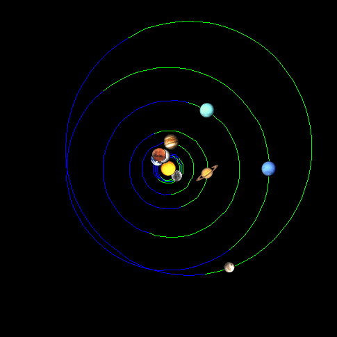
Shows Pluto Mercury the sun and Mars aligned for the main feature with Uranus Jupiter Mars (and also Earth and Venus with Neptune Saturn Mercury cramping the heat production.
Normally the adjacent planets do not align on average but statistically it is not impossible, when that happens and the sun is not involved temperatures are lower than the daily average.
When the planets align with the sun temperatures rise and large quake or swarm occurs. So today was an anomaly with several inner planets in sequence with Mercury and Pluto.
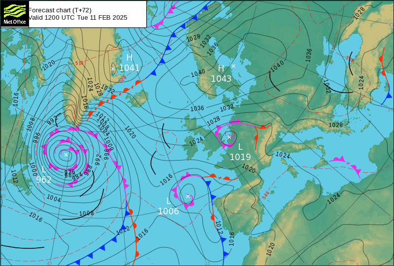
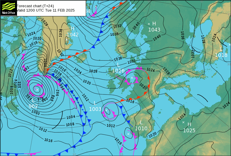
This Low with pinwheel Low-962 under Greenland is a classic volcanic eruption Tomograph, for anyone interested in their health Jehovah was using Cat Scans thousands of years before we were born. It is a work of art for keeping mankind out of Eden. Long out of use, the mountain in the Hyamalayas is well known to explorers and revered still by the native?


Mount Kailash is located in Ngari Prefecture, Tibet Autonomous Region of China.[8][9] It lies in the Gangdisê Mountains (also called as Kailash Range) of the Transhimalaya, in the western part of the Tibetan Plateau. The peak of Mount Kailash is at an elevation of 6,638 m (21,778 ft).[13][14] The region is located north of the western tripoint of the border between China, India and Nepal.[15]
The major rivers rising from the western Gangdise mountains are the Yarlung Tsangpo (which becomes the Brahmaputra), the Indus, the Sutlej and the Karnali, a tributary of Ganges. All these river systems originate within a 60 km (37 mi) stretch in the region.[13][16][17] Mount Kailash is located on the banks of Manasarovar and Rakshastal lakes. Spread over an area of 320 km2 (120 sq mi), Manasarovar is the highest freshwater lake in the world.[16][18][19]
What is interesting is that the browser I used mainly for collecting this data had gone squirrel on the USGS page and tonight the t-96 chart would not open. DuckDuckGo was not having democrat shenanigans
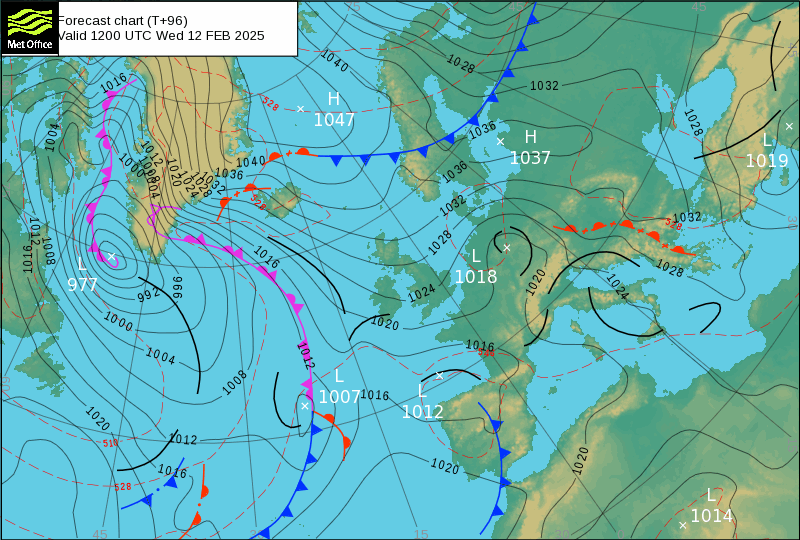
This chart is filled with troughs all the way through Europe, the thing with Troughs is they do no work or distribute no energy do they. So why do they get fed by physics?
That is one riddle but the other is more immediate, Low-977 (Nevado del Ruiz (Colombia): Explosive activity continues. Volcanic Ash Advisory Center (VAAC) Washington warned about a volcanic ash plume that rose up to estimated 20000 ft (6100 m) does not normally go up the Davies Straights. Back to bed to brood about things, odd things.
>does not normally go up the Davies Straights.
A little clearer. I couldn’t understand how a Central South American volcano throws a tomograph up into the Davies Straights. Of course, it is not in the Davies Straights, it is over the Straights in the lower atmosphere. The straights will have been frozen over all winter.
Why didn’t I see it before?
Obviously I never paid any attention. I have only been doing this for forty years, so go easy on me. It is a beauty though, isn’t it?