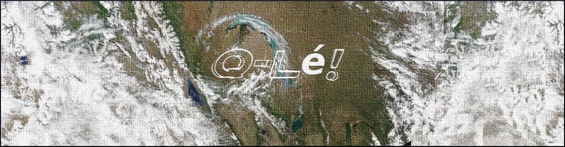
I am not sure what weather grift is but I’d be surprised if it is not this:
I was looking for the storm that ran from North America to Japanese waters in the south Pacific on Tropical Storm Risk but I was a day late and they had removed it from their servers, I think for honest reasons even though the site is run by an insurance company.
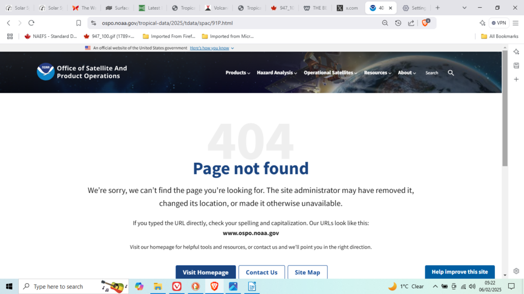
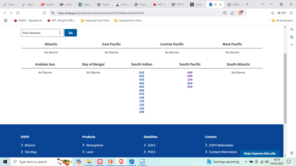
So I went to an archive so technical I couldn’t understand it: 91P
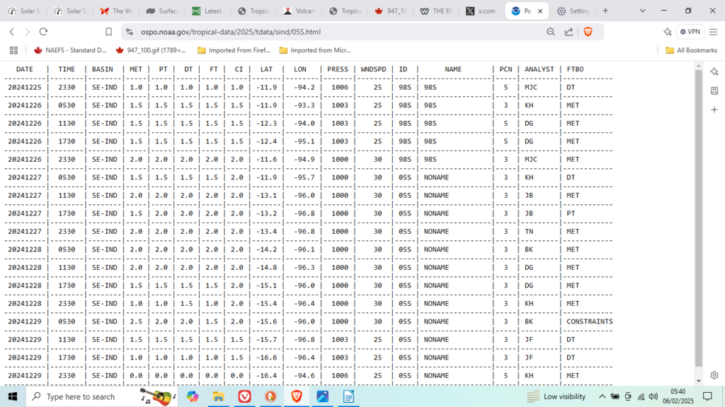
The trick is that the longitudes as ell as the latitudes. The problem being the line as a near perfect arc despite the rate of changes in the momentums of the gyre. Lets have a look at the adjacent 05S South Indian storm:
ait it redirects to Micronesia:
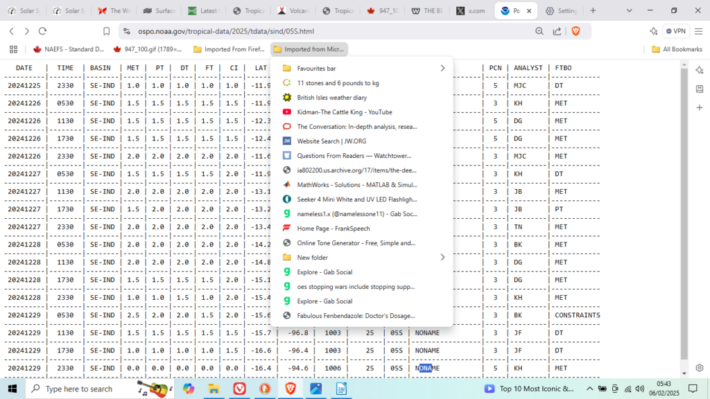
Oh.
Let’s try wikedpeado, they at least can be trusted. Crap!
What was I expecting?
A cursory glance at: https://watchers.news/category/severe-weather/ reveals nothing; boy I am glad I never sent them any money.
I had one hell of a job removing the stain of microsoft from these calc.odt quakes:
| 2025-01-29T01:32:59.222Z | -53.4247 | -41.4854 | 10 | 5.6 | mwb | South Atlantic Ocean |
| 2025-01-28T06:52:34.959Z | -28.1647 | -175.9982 | 10 | 5.8 | mww | Kermadec Islands region |
| 2025-01-28T00:59:47.990Z | -41.2057 | -90.2398 | 10 | 5.7 | mww | southeast of Easter Island |
| 2025-01-26T22:39:13.252Z | 53.1731 | -167.1997 | 59 | 5.6 | mww | 89 km SSW of Unalaska, Alaska |
| 2025-01-24T18:26:51.855Z | -3.9254 | 150.7678 | 10 | 5.7 | mww | 149 km S of Kavieng, Papua New Guinea |
| 2025-01-23T11:14:03.975Z | -12.8369 | 168.919 | 621.413 | 5.6 | mww | 187 km NE of Sola, Vanuatu |
| 2025-01-21T11:15:30.546Z | -3.7368 | 151.5823 | 10 | 5.5 | mww | 82 km NW of Rabaul, Papua New Guinea |
| 2025-01-21T06:05:14.352Z | -27.4829 | -13.4632 | 10 | 5.5 | mb | southern Mid-Atlantic Ridge |
| 2025-01-21T05:47:51.148Z | 13.4344 | 144.3969 | 137.242 | 5.5 | mww | 29 km WNW of Agat Village, Guam |
| 2025-01-20T16:17:26.768Z | 23.1678 | 120.5468 | 16 | 6 | mww | 9 km ENE of Yujing, Taiwan |
| 2025-01-20T08:38:43.517Z | -11.3327 | 165.8206 | 35 | 5.6 | mww | 67 km S of Lata, Solomon Islands |
| 2025-01-15T21:37:01.783Z | -10.9571 | 165.9879 | 48.106 | 5.7 | mww | 33 km SE of Lata, Solomon Islands |
| 2025-01-14T19:02:04.457Z | 7.2664 | -35.4561 | 10 | 5.6 | mww | central Mid-Atlantic Ridge |
| 2025-01-13T12:19:32.300Z | 31.8525 | 131.53 | 39 | 6.8 | mww | 12 km ESE of Miyazaki, Japan |
| 2025-01-12T08:32:50.219Z | 18.5928 | -103.2404 | 39 | 6.2 | mww | 22 km SSW of Coalcomán de Vázquez Pallares, Mexico |
| 2025-01-10T08:14:31.688Z | 5.9161 | -77.4676 | 10 | 5.6 | mww | 31 km NW of Nuquí, Colombia |
| 2025-01-09T16:31:45.323Z | 13.599 | -89.7339 | 95 | 5.8 | mww | 10 km E of Acajutla, El Salvador |
| 2025-01-08T07:44:22.703Z | 34.7612 | 97.4769 | 10 | 5.5 | mww | Southern Qinghai, China |
| 2025-01-07T08:31:32.423Z | 31.6482 | 138.3252 | 375.978 | 5.6 | mww | Izu Islands, Japan region |
| 2025-01-07T01:05:16.716Z | 28.5733 | 87.375 | 10 | 7.1 | mww | 2025 Southern Tibetan Plateau Earthquake |
| 2025-01-05T17:18:45.784Z | 13.0007 | -89.1775 | 46 | 6.2 | mww | 56 km SSE of La Libertad, El Salvador |
| 2025-01-04T00:52:21.180Z | 9.4995 | 40.1563 | 8 | 5.7 | mww | 56 km SSE of Abomsa, Ethiopia |
| 2025-01-02T20:43:35.253Z | -21.7109 | -69.1069 | 99 | 6.1 | mww | 84 km NNW of Calama, Chile |
| 2025-01-01T13:48:25.461Z | -56.4048 | -26.692 | 76.372 | 6.1 | mww | South Sandwich Islands region |
| 2025-01-01T04:39:16.312Z | -20.9201 | 169.397 | 10 | 5.5 | mww | 153 km S of Isangel, Vanuatu |
| 2024-12-30T05:41:06.678Z | -29.9272 | -71.9959 | 10 | 5.5 | mww | 63 km W of Coquimbo, Chile |
| 2024-12-30T05:40:49.261Z | -29.9195 | -72.0562 | 10 | 5.5 | mb | 69 km W of Coquimbo, Chile |
| 2024-12-30T02:56:16.863Z | 18.4588 | 120.8824 | 34 | 5.5 | mww | 14 km SE of Bangui, Philippines |
Note there was nothing larger than 5.5M since the 29 January to date 6th February.
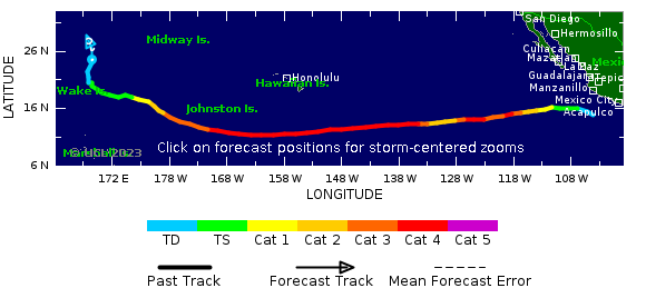
This is the storm I was looking for yesterday. More later when I have had a look at it. Tropical Depression DORA how about that for fairly mild storm?
I have someone helping me set out the solar system, she has no idea what this is about.