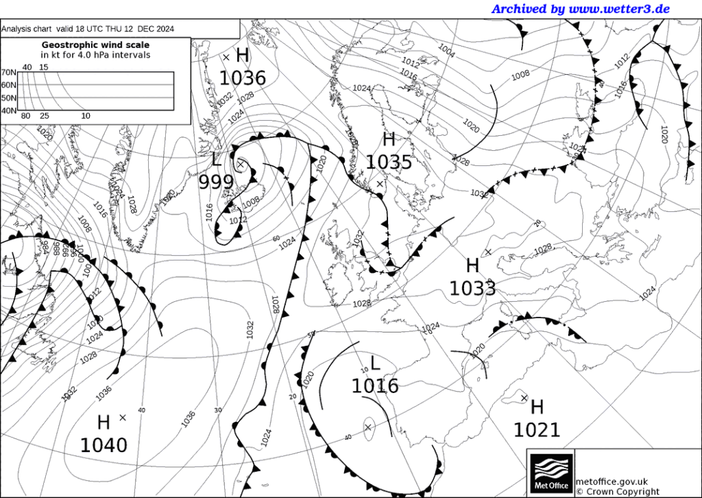
This stuff is copyrighted by the Met office but posted though a private ciizen’s server via VetterZentrale’ repeater. I am using them for public use because of their accuracy and because I am looking for results the Met Office is hiding from the general public.
I have just taken some nicotine to overcome Long Covid obtained for a local hospital whilst also suffering toothache my dentist can’t find a cause of, so bear with me, please; the effect of volcanic eruptions is uncanny were it not for the fact I have been studying this shtuff’s remarkable ability to destrory my spelling during powerful eruptions.
And I don’t believe in coincidences.
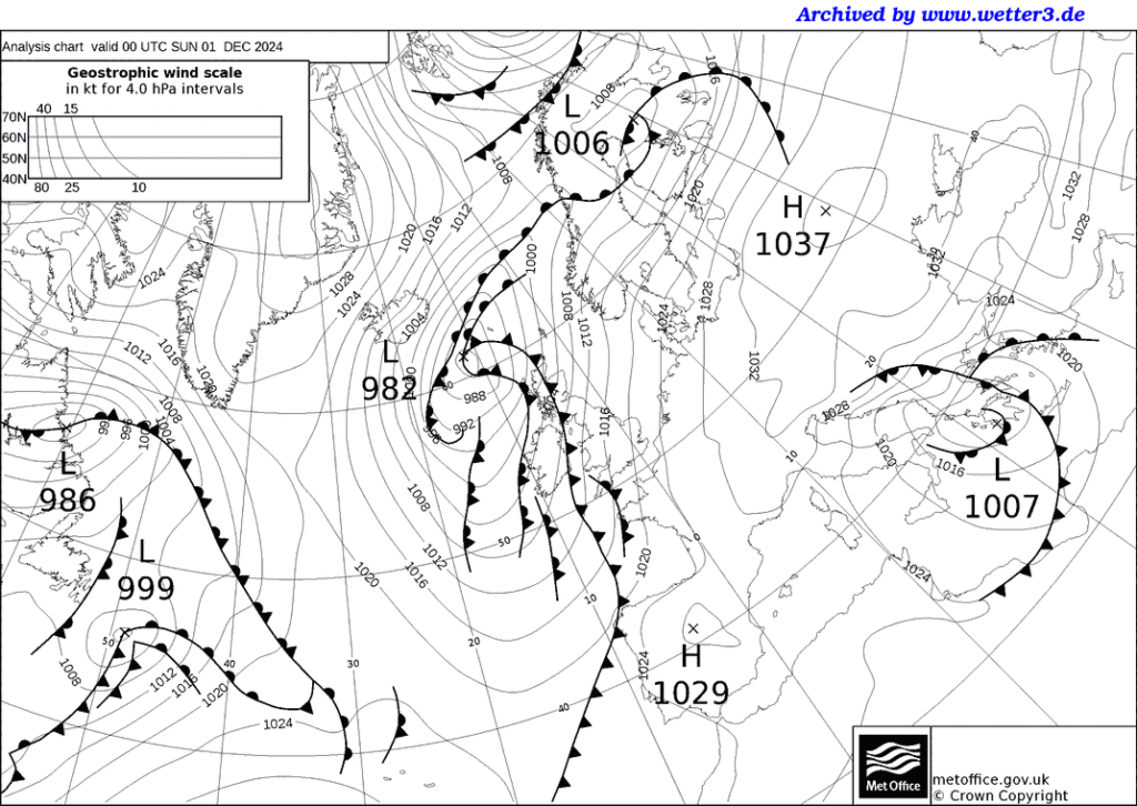
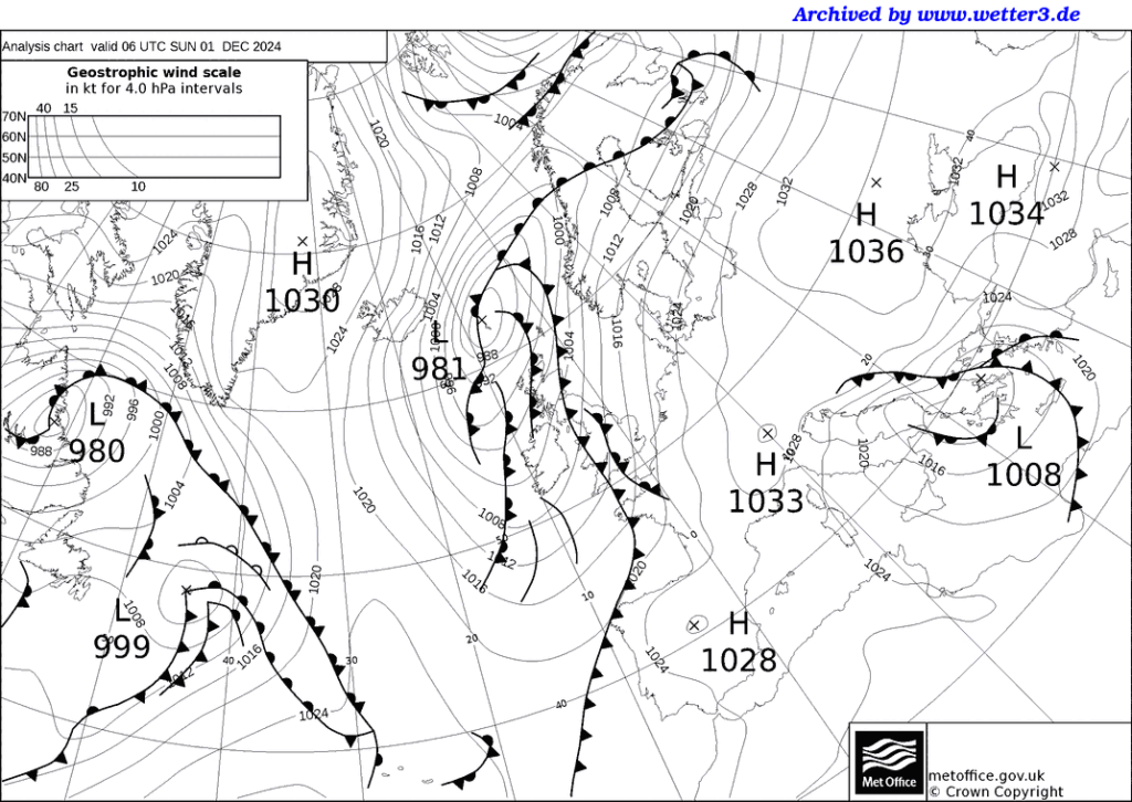
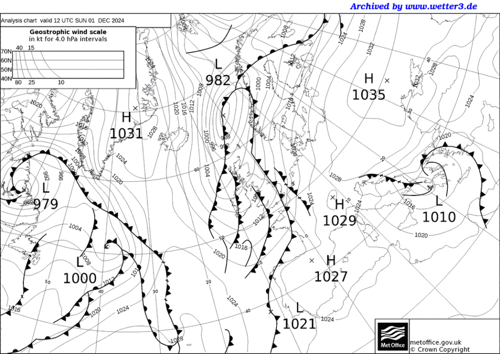
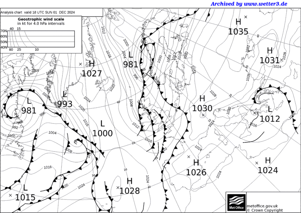
“The Pembrokeshire Dangler is a convergence zone which forms a line of continuous showers aligned north-south across the Irish sea; it often occurs during late autumn and winter, since the environmental factors required for its formation such as warm sea temperatures and cold Arctic air aloft are usually only met at this time of year.”
“It is a line of showery precipitation which forms in a NNW to NNE airflow, typically from north of Pembrokeshire to Cornwall. This often results in frequent showers, or even more persistent rain, in quite a narrow band. It is by no means an unusual phenomenon, occurring several times a year, particularly in autumn and winter. The long fetch across ‘warm’ water from the Irish Sea to Cornwall, provides the right conditions for showers to form. The shape of the Pembrokeshire Peninsula has the effect of concentrating this unstable northerly flow, in the same way as an obstruction in a stream would concentrate the flow around it.”
You can also see the same thing reproduced on the east coast of North America.
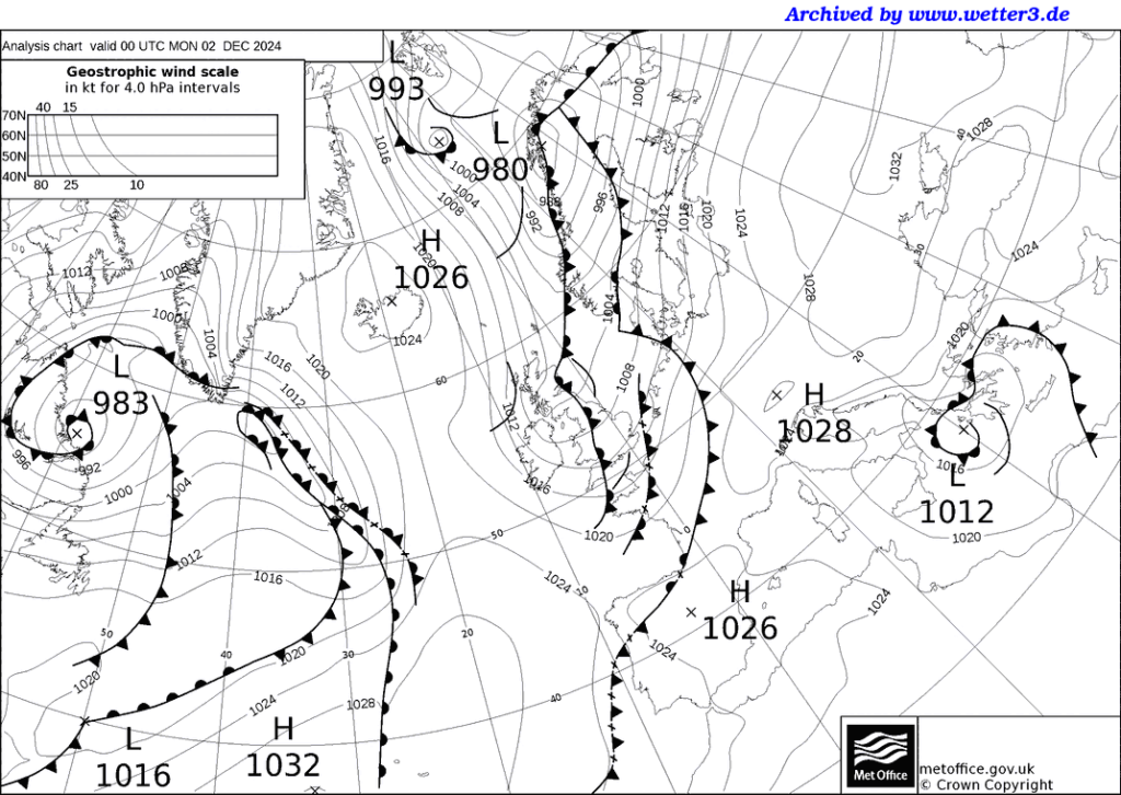
With that Dangler’s effects on the Greenland High (Semeru, the one previously mentioned in the post: Pinatubo too.)
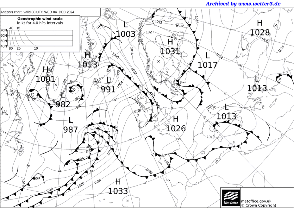
Which lasted until the one over Britain transformed into an Anticyclones stalled again until the reappearance of the Greenland High on the 4 December charts at which time I swallow my nicotine gum and take a couple of anti-histamine tablets and belt of cider wine (11:30, 14 December 2024.)
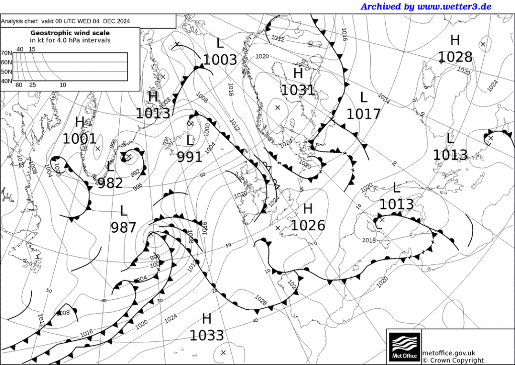
Oops! I ran a little previous with the anticyclones. Time to check out the volcanic activity. This looks like it is going to turn into a VERY LOOoooong post akin to the blog post The monkey that felled a statute.
Sorry.
Svartsengi (Reykjanes peninsula, SW Iceland): (4 Dec) The eruption continues at stable levels.
Spattering continues to feed the lava flowing to the southeast towards Fagradalsfjall and simultaneously keeps growing the main cinder cone. Unlikely to register n the MetO charts
Manam (Papua New Guinea): Explosive activity continues. Volcanic Ash Advisory Center (VAAC) Darwin warned about a volcanic ash plume that rose up to estimated 7000 ft (2100 m) altitude or flight level 070 .
The full report is as follows: VA TO FL070 OBS AT 04/1220Z MOV WNW EST VA DTG:04/1740Z to 7000 ft (2100 m)
Ibu (Halmahera, Indonesia): Explosive activity continues. Volcanic Ash Advisory Center (VAAC) Darwin warned about a volcanic ash plume that rose up to estimated 7000 ft (2100 m)
Lewotobi (Flores): (4 Dec) Explosive activity continues. Volcanic Ash Advisory Center (VAAC) Darwin warned about a volcanic ash plume that rose up to estimated 8000 ft (2400 m)
Semeru (East Java, Indonesia): Explosive activity continues. Volcanic Ash Advisory Center (VAAC) Darwin warned about a volcanic ash plume that rose up to estimated 15000 ft (4600 m)
Dukono (Halmahera): Explosive activity continues. Volcanic Ash Advisory Center (VAAC) Darwin warned about a volcanic ash plume that rose up to estimated 16000 ft (4900 m)
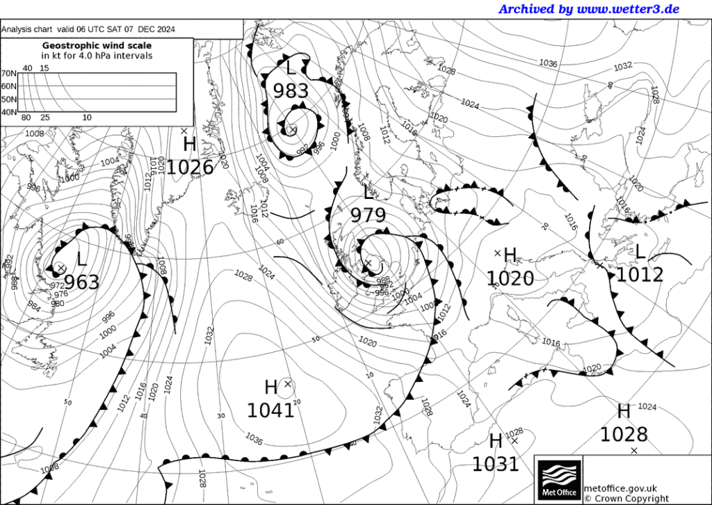
Manam Ibu and Lewotobi might register for all I know, Semeru certainly did, I suspect Dukono is beside it as an High-1030. I have no idea what the High-1033 is at the bottom of the chart is. A composite of the other oriental ones?
All the following American ones are cyclones. Potocatapetl is interesting L-982, as is Sangay L-991. I am going to need help to sort all this muck out. And another dose of pain-killer, perhaps. Owww!
Popocatépetl (Central Mexico): Explosive activity continues. Volcanic Ash Advisory Center (VAAC) Washington warned about a volcanic ash plume that rose up to estimated 21000 ft (6400 m)
Santiaguito (Guatemala): Explosive activity continues. Volcanic Ash Advisory Center (VAAC) Washington warned about a volcanic ash plume that rose up to estimated 14000 ft (4300 m)
Fuego (Guatemala): Explosive activity continues. Volcanic Ash Advisory Center (VAAC) Washington warned about a volcanic ash plume that rose up to estimated 15000 ft (4600 m)
Sangay (Ecuador): Explosive activity continues. Volcanic Ash Advisory Center (VAAC) Washington warned about a volcanic ash plume that rose up to estimated 20000 ft (6100 m) altitude or flight level 200 .
The full report is as follows: DISCRETE VA EMS to 20000 ft (6100 m)
Reventador (Ecuador): Explosive activity continues. Volcanic Ash Advisory Center (VAAC) Washington warned about a volcanic ash plume that rose up to estimated 14500 ft (4400 m)
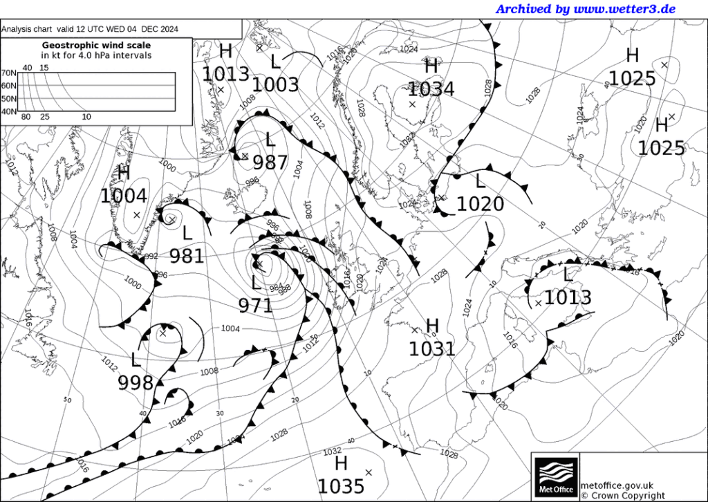
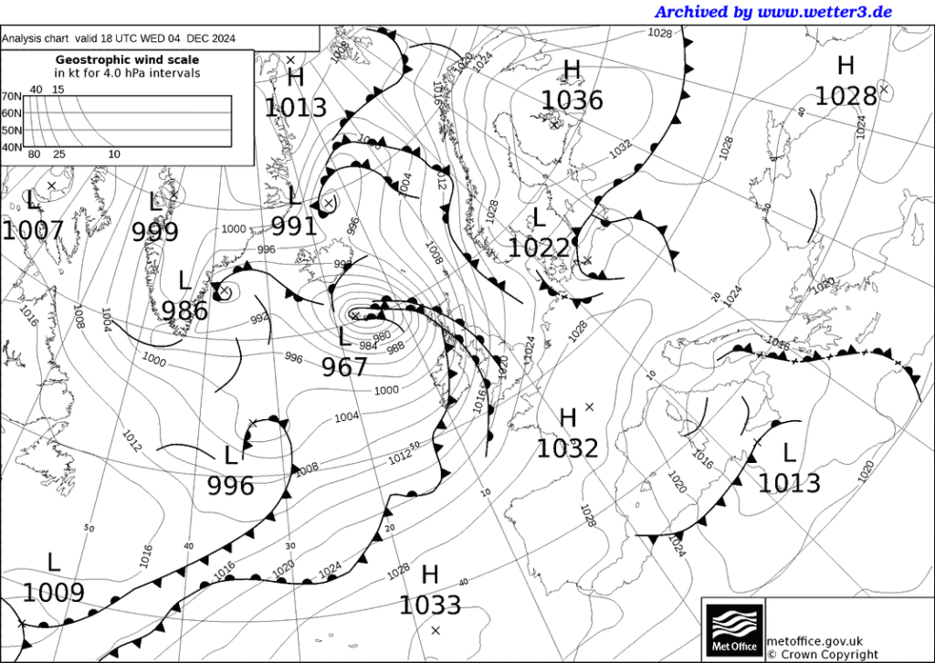
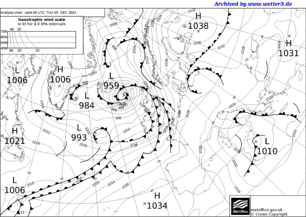
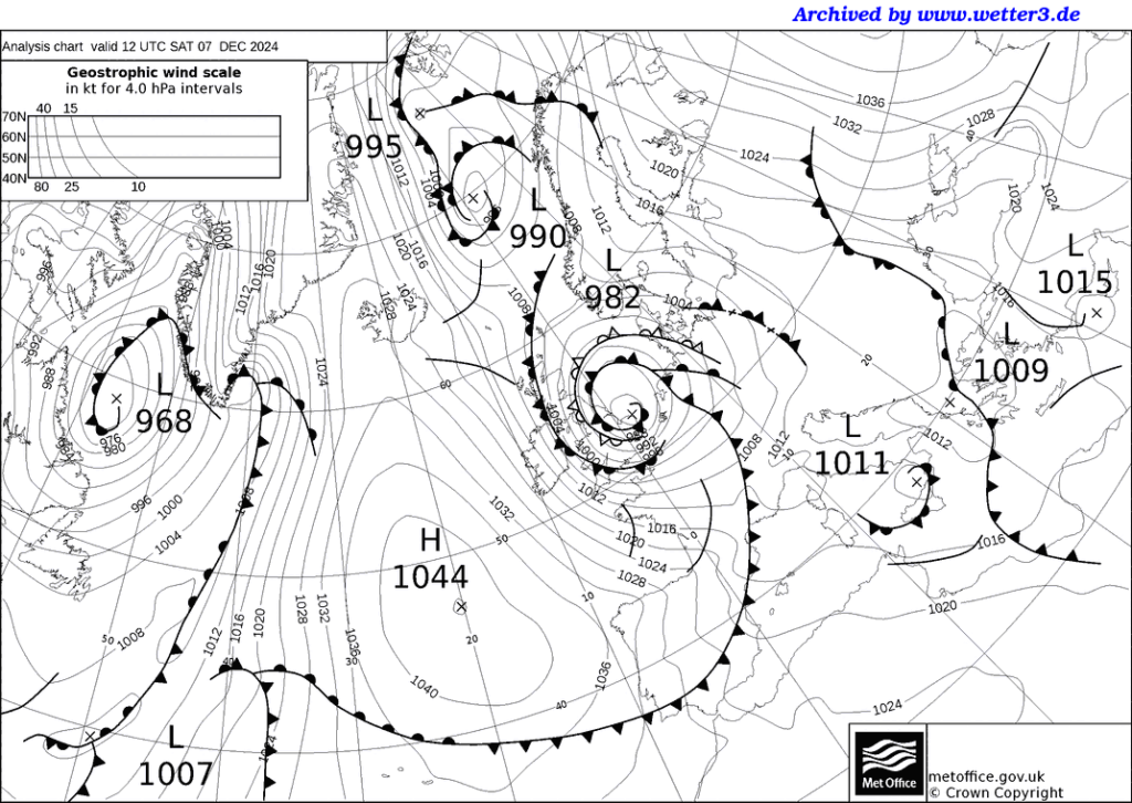
Low-959 in the middle of the chart…
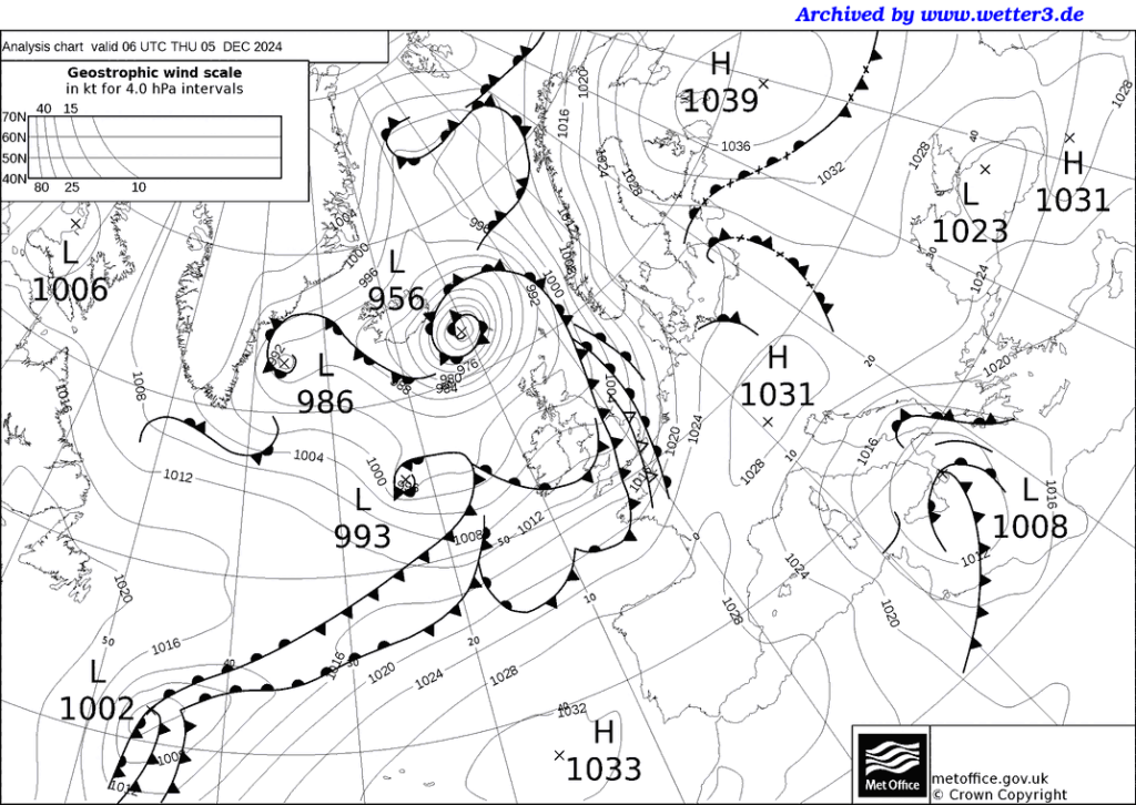
Becomes Low956
5.6M. 37 km SE of Masjed Soleymān, Iran 2024-12-05 04:02
Volcano Activity Summary for 4 Dec 2024
5.6M. 166 km SW of Nikolski, Alaska 2024-12-05 11:48
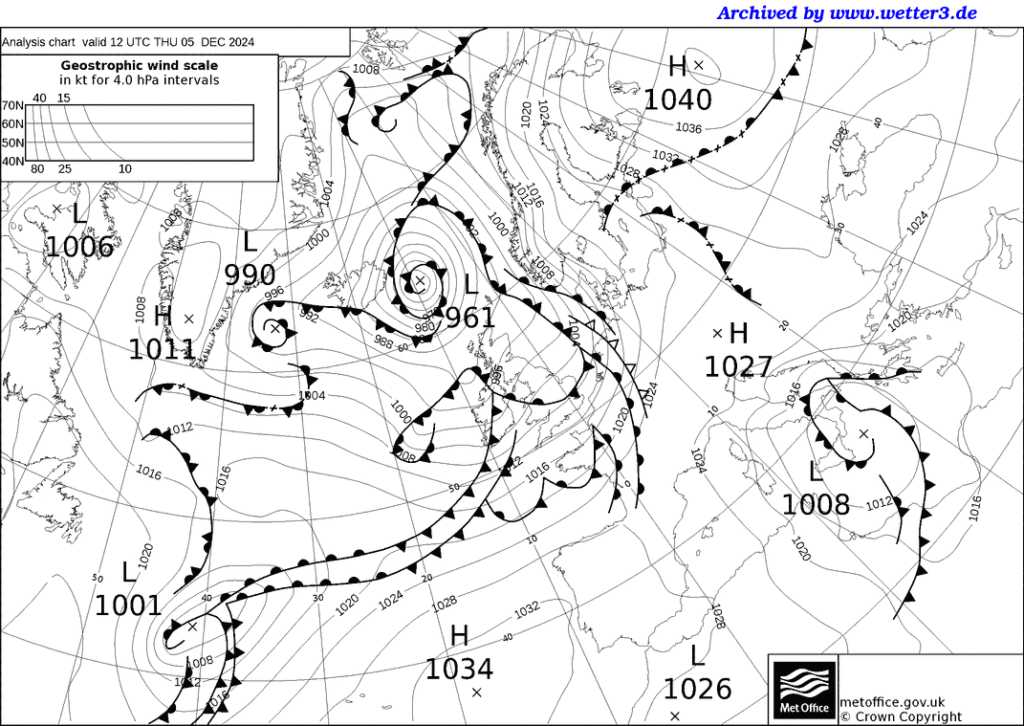
Becomes Low 961 Sangay (Ecuador): Explosive activity continues. Volcanic Ash Advisory Center (VAAC) Washington warned about a volcanic ash plume that rose up to estimated 20000 ft (6100 m) after the eruption.
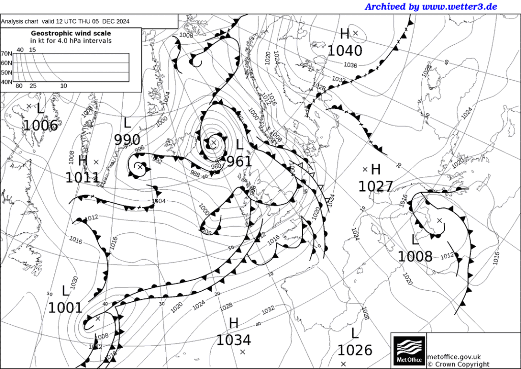
7.0M. 2024 Offshore Cape Mendocino, California 2024-12-05 18:44. At least, it looks like it was Sangay. Let the reader use discernment.

There is obviously a lot going on, with Jupiter and Earth aligning with the sun and Mercury supplying the torque; whilst Pluto Mercury and Mars align.
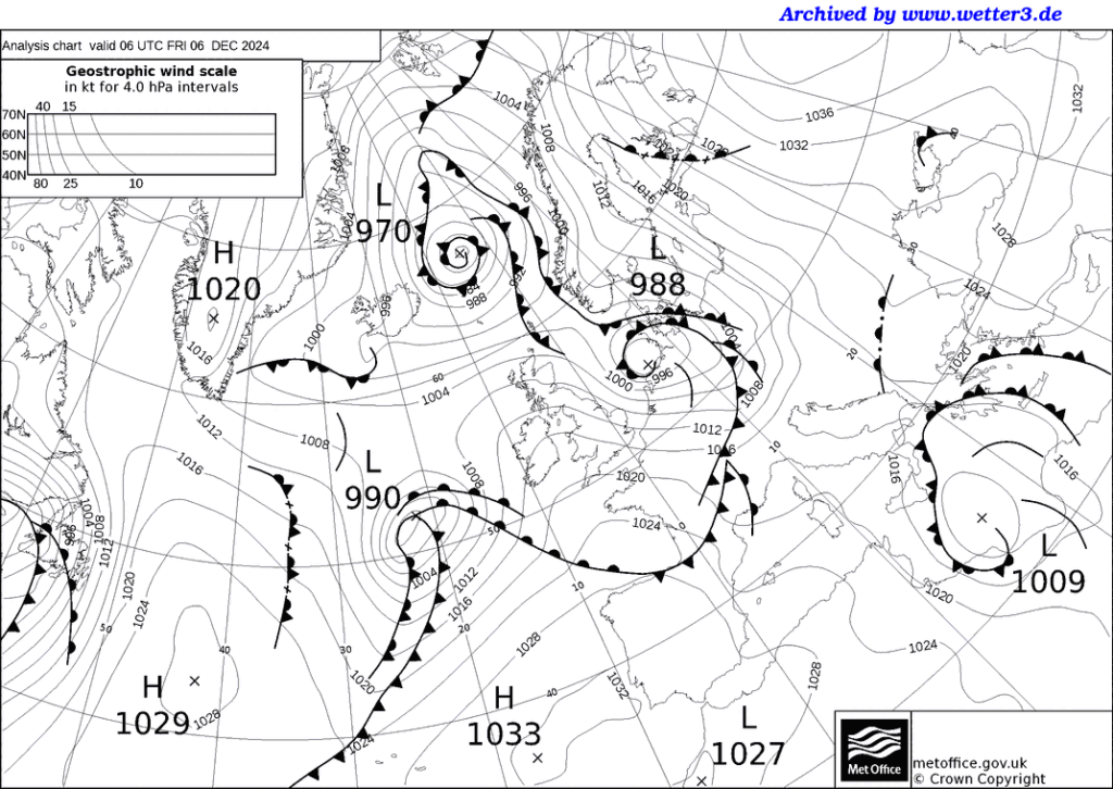
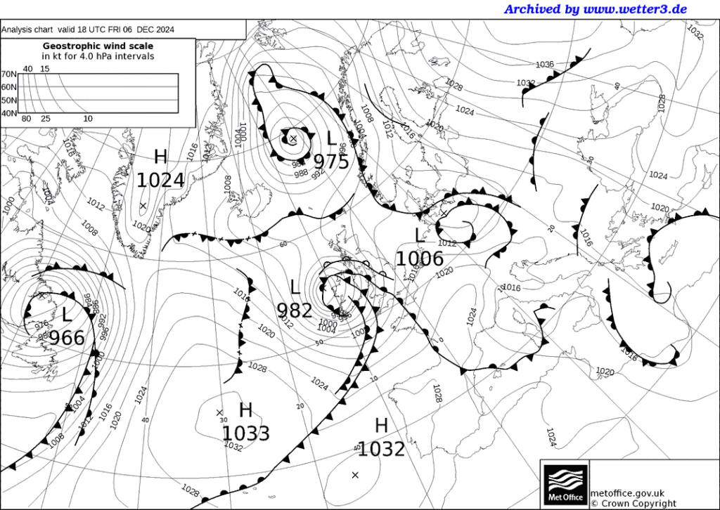
That’s defintely Italian, is that a Russian or an Aleutian on its
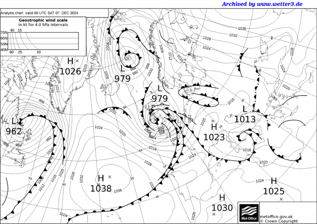
That’s definitely Etna, whatever
With maybe a touch of Stromboli
6.0M. Kuril Islands 2024-12-08 10:24
5.5M. central East Pacific Rise 2024-12-08 16:41
5.6M. central East Pacific Rise 2024-12-08 18:07
6.3M. 113 km SSW of Adak, Alaska 2024-12-08 19:57
5.8M. 119 km SSW of Adak, Alaska 024-12-08 21:02

See how the weather changes even with relatively small significant earthquakes?
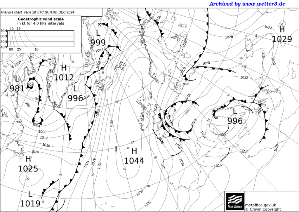
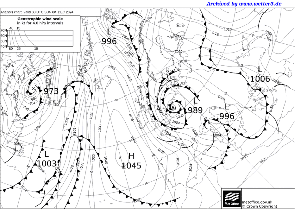
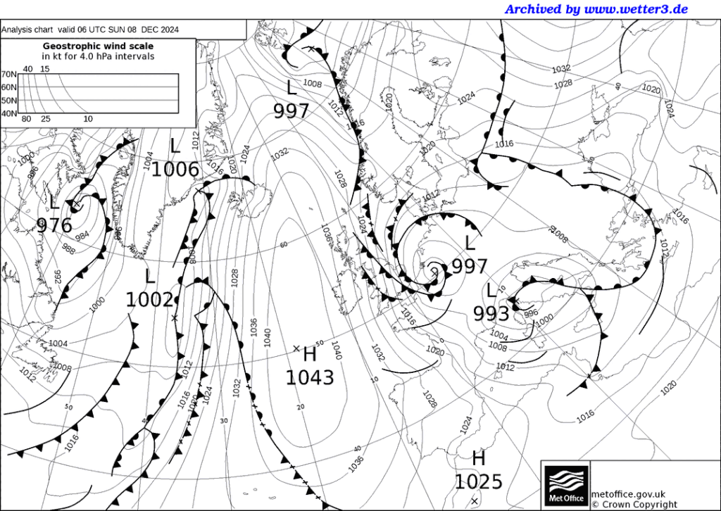
And we are back with Semeru, ready to start again:

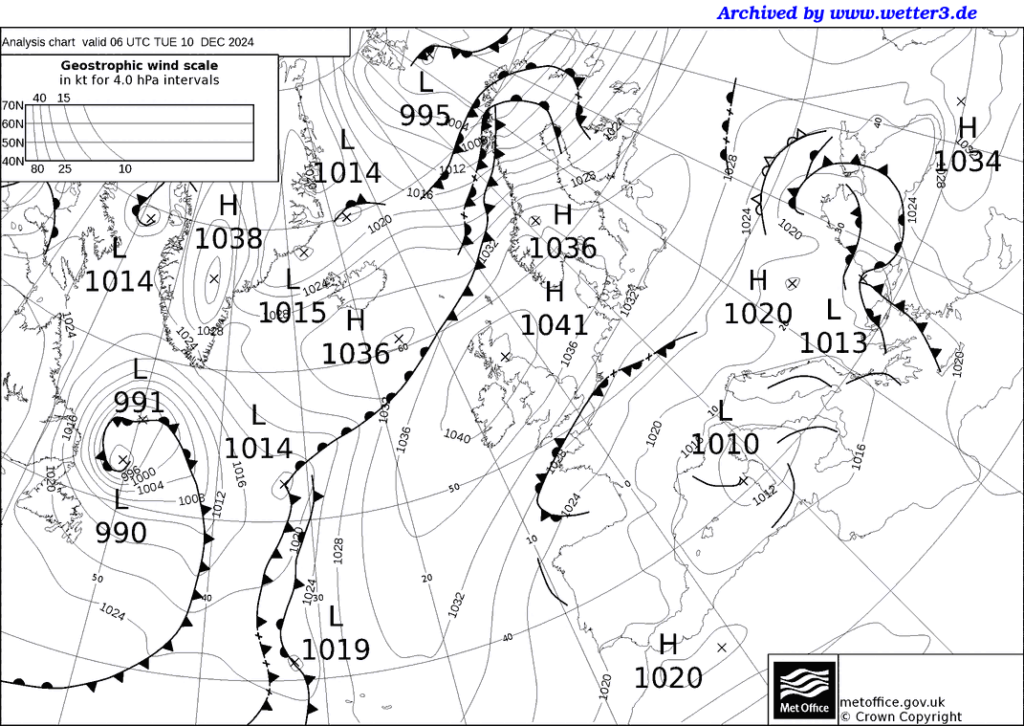
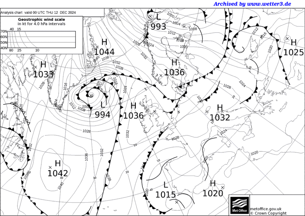
I think we should start looking for two volcanoes in what I call a dual
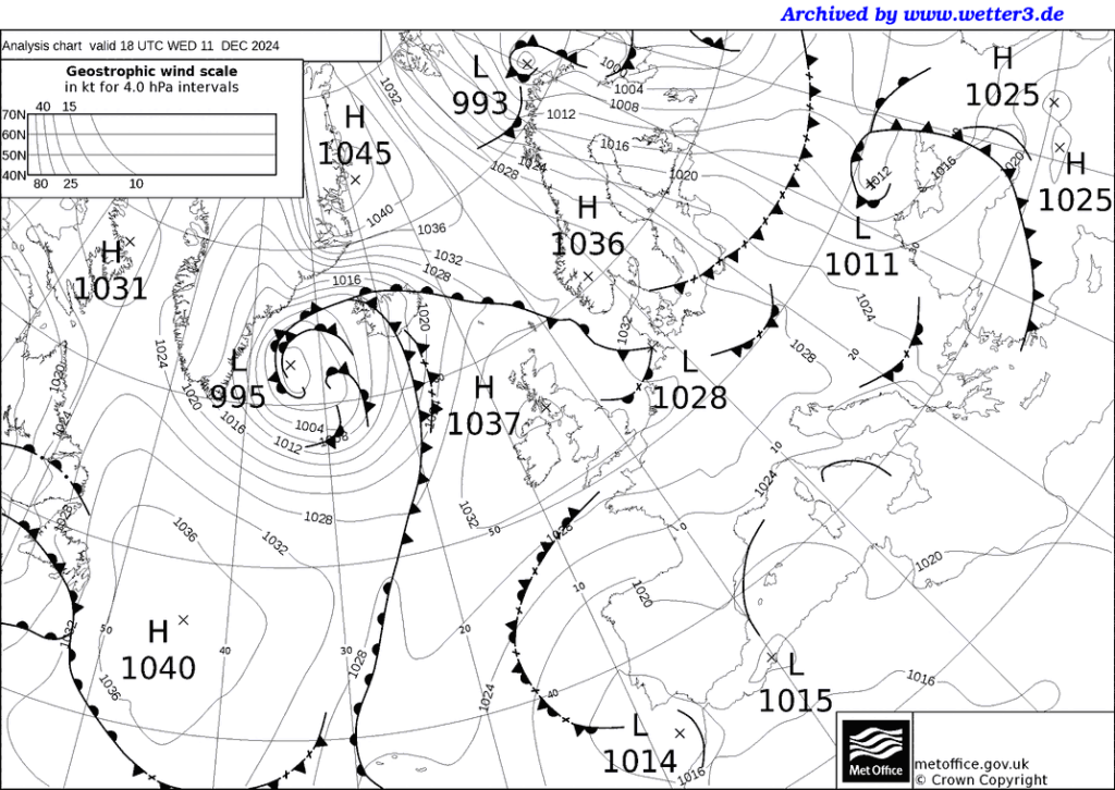
Or maybe not, that High on the top left
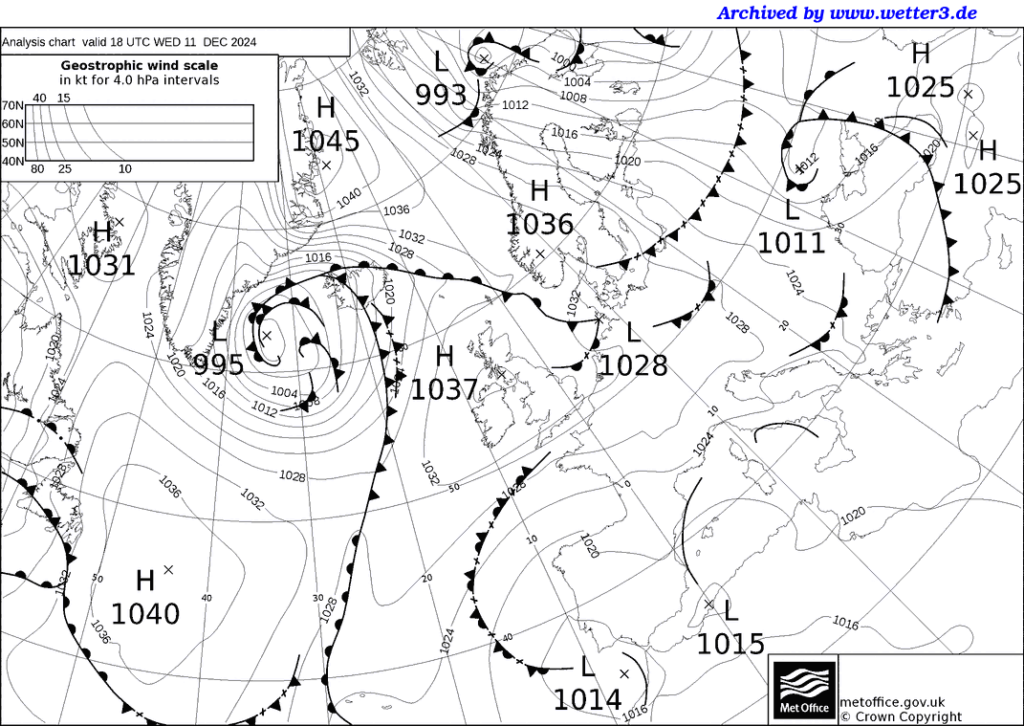
blocked it. They don’t like dealing with dual Highs, in my opinion
6.3M. 105 km SSW of Adak, Alaska 2024-12-09 00:15
6.1M. 128 km SSW of Adak, Alaska 2024-12-09 00:38
The truth is I don’t either. That might be because I never dealt with a New Zealander before:
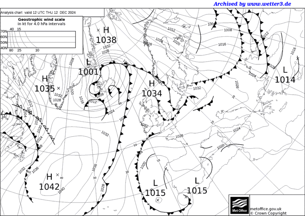
White Island (New Zealand): (14 Dec) Explosive activity continues. Volcanic Ash Advisory Center (VAAC) Wellington warned about a volcanic ash plume that rose up to estimated 2000 ft (600 m) 20,000 could well have been that H-1033 or even the H-1042 for all I know. The way to say is to watch each day between first report and its going away.
It must be time to look at the tornado reports.
5.7M. 124 km SSW of Adak, Alaska 2024-12-09 03:26
5.6M. 128 km SSW of Adak, Alaska 2024-12-09 03:31
5.6M. 9 km S of Conchagua, El Salvador 2024-12-09 03:50
5.8M. 24 km NNE of Yerington, Nevada 2024-12-09 23:08

5.8M. 93 km SSW of Adak, Alaska 2024-12-10 18:04

5.5M. 91 km SSW of Alo, Wallis and Futuna 2024-12-12 01:51
6.4M. 41 km ESE of Molina, Chile 2024-12-13 23:38
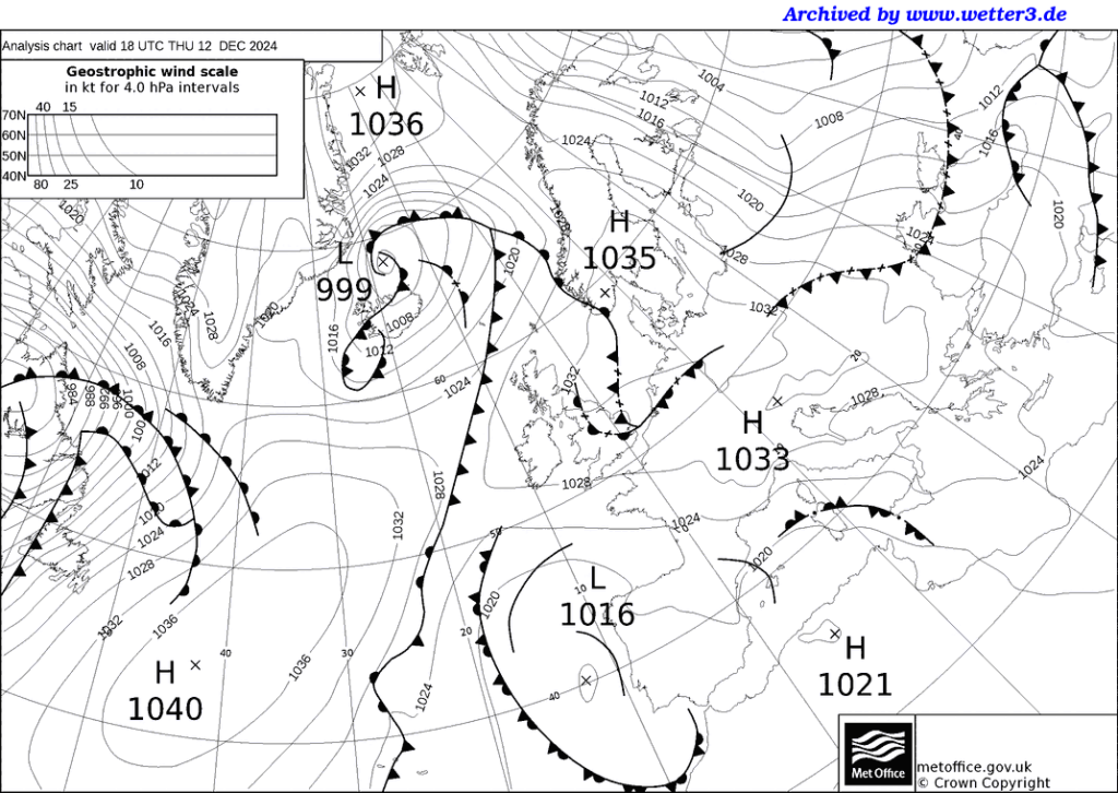
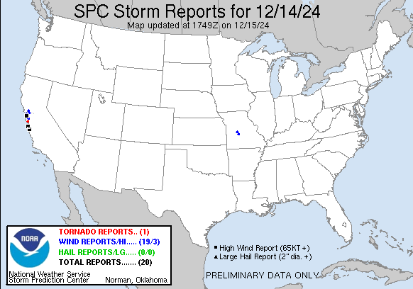
That was a surprise,no torenado reports for the USA. I was expecting Line storms and what have you…
https://www.spc.noaa.gov/climo/reports/241214_rpts.html
I missed this Yesterday, It was so tight on the California coast, that is my excuse:

I much prefer the forecast charts with their Big Friendly Red Letters:

Livid blue danglers.

Tornadoes and all:

And so it ends:
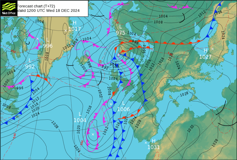
And it’s over for now:
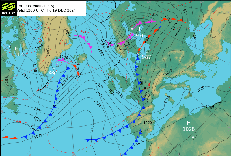
But that doesn’t mean it won’t start again:
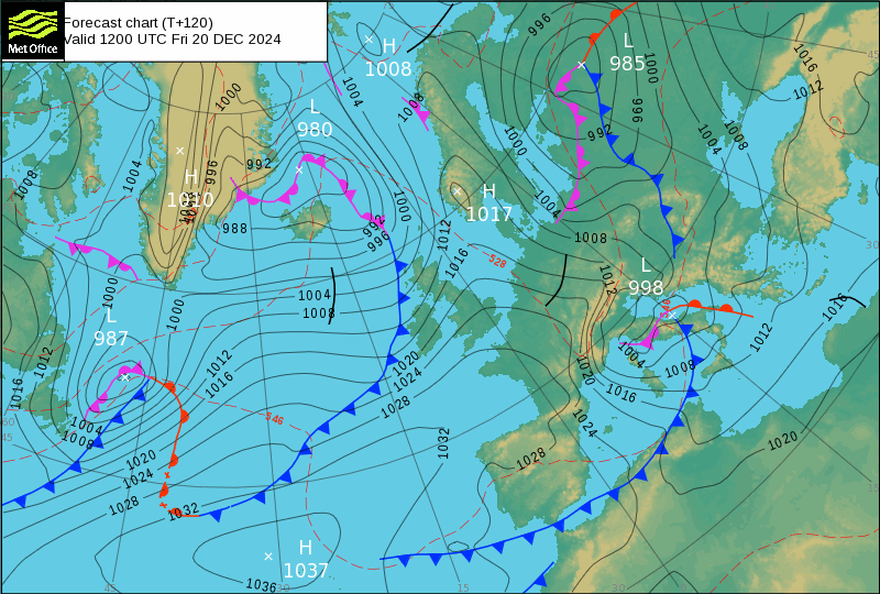
So Wednesday afternoon 18 December 2024, bar the shouting:
M 7.3 – 30 km W of Port-Vila, Vanuatu 2024-12-17 01:47 17.686°S 168.034°E
I dare say many scientists would call that a failure but when you consider I was working with phase changing based on someone else’s interpretation of the weather several days in advance, I’d call it a win in a game of 4D chess.
M 7.0 – 2024 Offshore Cape Mendocino, California 2024-12-05 18:44 40.374°N 125.022°W and consider that he Magnitude is 0.3 greater, spot on.

