5.5M. south of the Fiji Islands 2024-10-22 16:45:36 (UTC+01:00)459.1 km
4.9M. 49 km SSW of Labuha, Indonesia 2024-10-22 13:48:54 (UTC+01:00)10.0 km
4.7M. 214 km E of Levuka, Fiji 2024-10-21 21:25:35 (UTC+01:00)550.3 km
4.5M. 63 km S of Labuha, Indonesia 2024-10-21 20:22:50 (UTC+01:00)10.0 km
4.5M. 245 km ENE of Levuka, Fiji 2024-10-21 17:02:44 (UTC+01:00)530.5 km
4.6M. 63 km S of Labuha, Indonesia 2024-10-21 16:15:13 (UTC+01:00)10.0 km
5.0M. 51 km S of Labuha, Indonesia 2024-10-21 09:35:08 (UTC+01:00)10.0 km
5.2M. 60 km S of Labuha, Indonesia 2024-10-21 09:24:06 (UTC+01:00)10.0 km
4.9M. 65 km SSW of Labuha, Indonesia 2024-10-21 09:08:33 (UTC+01:00)10.0 km
5.7M. 52 km S of Labuha, Indonesia 2024-10-21 07:32:35 (UTC+01:00)10.0 km
4.5M. 224 km E of Levuka, Fiji 2024-10-21 07:09:39 (UTC+01:00)569.4 km
5.2M. 53 km S of Labuha, Indonesia 2024-10-21 05:12:15 (UTC+01:00)10.0 km
4.8M. 52 km S of Labuha, Indonesia 2024-10-21 05:10:22 (UTC+01:00)10.0 km
4.9M. 74 km SSW of Labuha, Indonesia 2024-10-21 04:53:04 (UTC+01:00)10.0 km
5.8M. 60 km S of Labuha, Indonesia 2024-10-21 04:24:16 (UTC+01:00)16.0 km
5.7M. 63 km NNW of Albardón, Argentina 2024-10-20 23:59:40 (UTC+01:00)107.7 km
4.6M. 74 km WNW of El Aguilar, Argentina 2024-10-20 14:56:17 (UTC+01:00)230.6 km
5.4M. Fiji region 2024-10-20 13:31:07 (UTC+01:00)589.0 km
4.8M. south of the Fiji Islands 2024-10-20 11:06:51 (UTC+01:00)
There is some Japanese stuff and more Indonesian ones you can check on it for yourselves
THE FAKE WEATHER REDUCES THE MAGNITUDES OF EARTHQUAKES
Not only is the ‘quake ameliorated but the magnitude of the one epicentre is spread over a significant region, so far as I can see, remaining in the same quadrisphere. Fancy that, Jehovah may have arranged for us to do something about earthquakes of our own volition. Just think of it, Acts of God after Amageddon will be acts of man on earth just like he designed us to become under his son: The Prince Of Peace: In his image.
So now we have a possible Tell for fake weather we can go back in time to look for other earquake runs. People affected by such unusual quakes can now have a shot at deepstate actors, restoring equity to those from whom it was taken.
6.0M. 18 km W of Doğanyol, Turkey 2024-10-16 08:46:
5.9M. 40 km SSW of Jurm, Afghanistan 2024-10-16 19:56
5.9M. 224 km SW of José María Morelos, Mexico 2024-10-16 20:40 to
5.8M. 60 km S of Labuha, Indonesia 2024-10-21 04:24
5.7M. 63 km NNW of Albardón, Argentina 2024-10-20 23:59
That’s a four or five day gap that I was looking for from 16 October 08:46 for Mercury Sol Mars
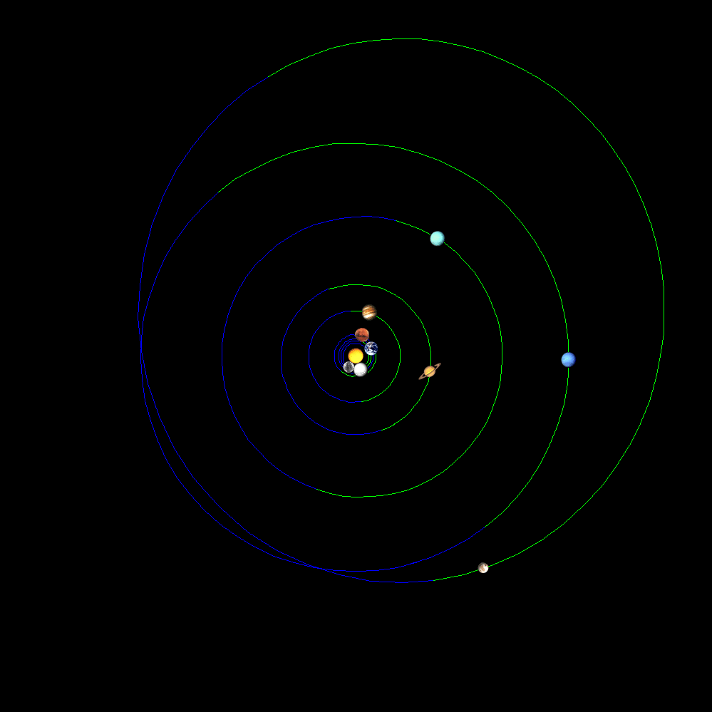
to 21 October 2024
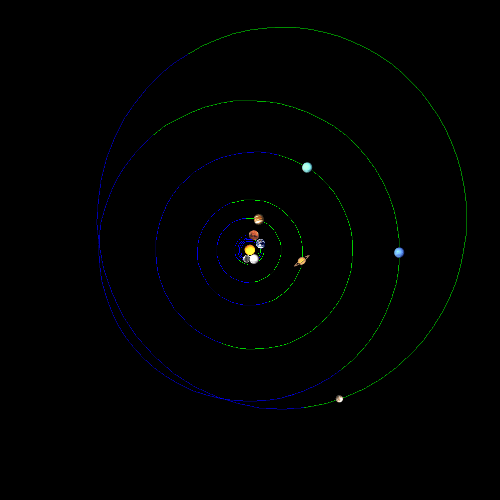
So now that we know what is going on, we ask Jehova what he wants us to do about it. Or does he want us to wait and see what Jesus has in mind for our eventual servants.
The next spell starts: 6.2M. 145 km SSW of Severo-Kuril’sk, Russia 2024-10-23 15:38
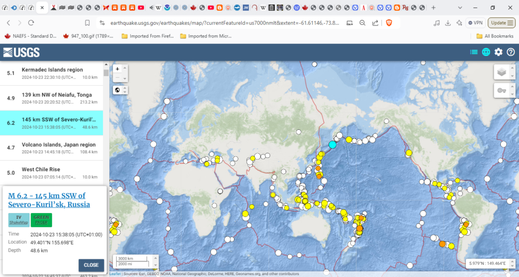
But Kristy is still going and stonger and it looks like someone is pointing it at Hawaii. How did it change colour without changing track?

Dana just got started:

Trami.
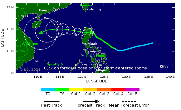

2024-10-23 15:28
Jupiter Sol Mecury. Pending: Pluto Sol Mercury, a continuum never ends. Given another four or five days it will be Jupiter Sol Mercury and Pluto Mercury Sol again:
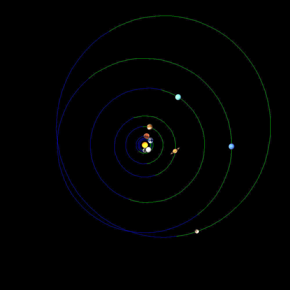
2024-10-28 15:28
I wish I had a more sensitive ephemeris.
And just like that the south and Central American volcanoes are pouring:
Popocatépetl (Central Mexico): Explosive activity continues. Volcanic Ash Advisory Center (VAAC) Washington warned about a volcanic ash plume that rose up to estimated 24000 ft (7300 m)
Fuego (Guatemala): Explosive activity continues. Volcanic Ash Advisory Center (VAAC) Washington warned about a volcanic ash plume that rose up to estimated 15000 ft (4600 m)
Nevado del Ruiz (Colombia): Explosive activity continues. Volcanic Ash Advisory Center (VAAC) Washington warned about a volcanic ash plume that rose up to estimated 20000 ft (6100 m)
Sangay (Ecuador): Explosive activity continues. Volcanic Ash Advisory Center (VAAC) Washington warned about a volcanic ash plume that rose up to estimated 20000 ft (6100 m) altitude or flight level 200 .
The full report is as follows: NEW VA EMS to 20000 ft (6100 m)
There are no coincidences, a slogan from the first campign of President trump. try selling that to the element of meteorology:

I don’t understand why a storm that is a tomograph heads north into oblivion. I think it goes to ground in Russia or the Mackenzie river. Sometimes a strom will go around the Arctic for as long as 3 weeks or more before dropping down into the gap between Russia and North America.
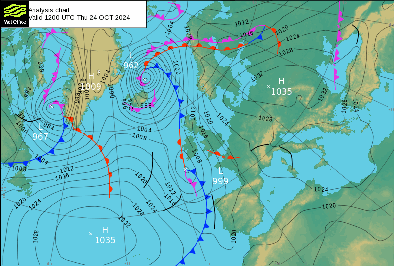
Either this is perfectly normal or it only began happening in the Clinton era. In other words a safe pair of hands while they learned how to deal with fake weather. I am looking at 962 offGreenland:
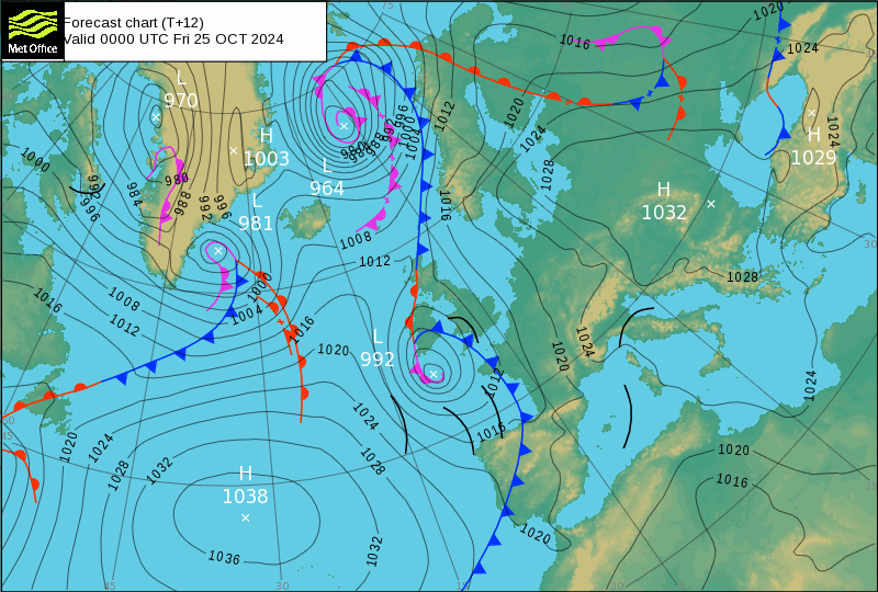
964 off norway and filling:
963 and about gone:
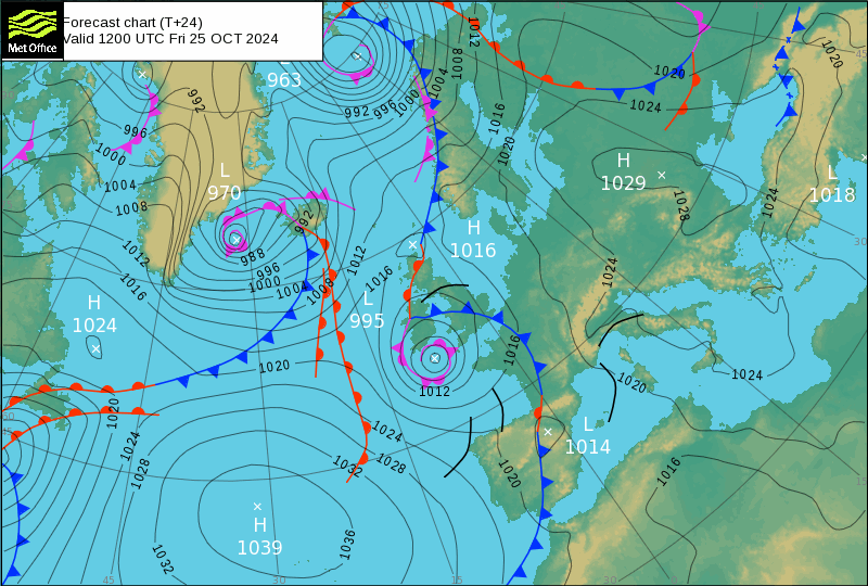
Nice one Vivaldi playing silly buggers and losing my stuff, Britain and Ireland are on the top right but skewed so difficult to see.
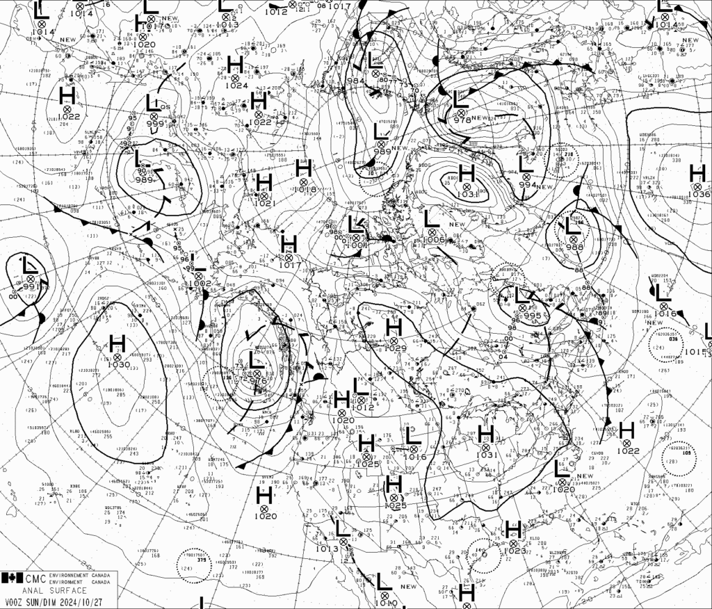
Popocatapetl will be near the top rightLow-988
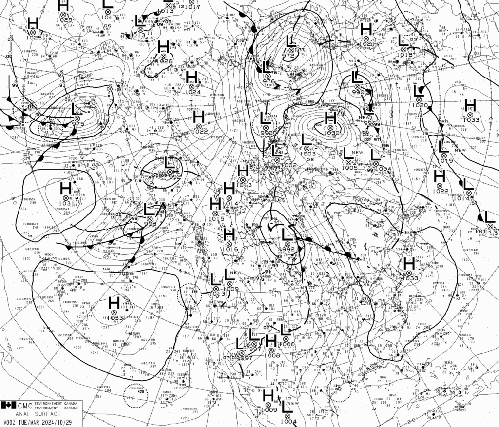
I have no idea where it is now but at 28 thousand feet it cam’t be hiding very well.
Popocatépetl (Central Mexico): Explosive activity continues. Volcanic Ash Advisory Center (VAAC) Washington warned about a volcanic ash plume that rose up to estimated 28000 ft (8500 m)
I am pretty sure it is just in sight at the top centre: Low-990 on the Canadian chart.
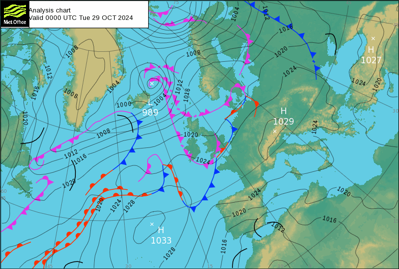
So Low-981 on the Met Office chart will be a dual of Nevado del Ruis and Sabancaya. One othe three is going to erupt when it gets the right situation.
Nevado del Ruiz (Colombia): Explosive activity continues. Volcanic Ash Advisory Center (VAAC) Washington warned about a volcanic ash plume that rose up to estimated 21000 ft (6400 m)
Sabancaya (Peru): Explosive activity continues. Volcanic Ash Advisory Center (VAAC) Buenos Aires warned about a volcanic ash plume that rose up to estimated 23000 ft (7000 m)

