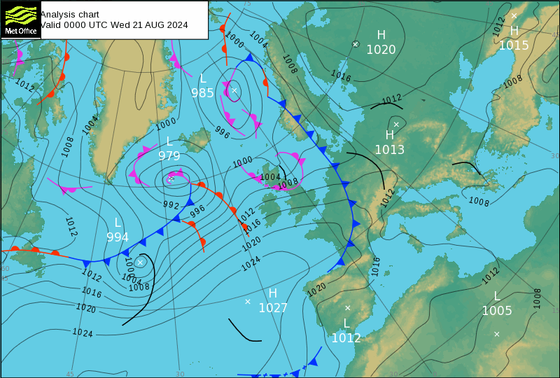
Something has to explain the arrival of the anticyclone in the south of this North Atlantic chart.

Actually I was tempted to try a forecast for Asian volcanoes for the firt time in a while. What enticed me was the size of the cold fronts with this eruption of:
Nevado del Ruiz (Colombia): Explosive activity continues. Volcanic Ash Advisory Center (VAAC) Washington warned about a volcanic ash plume that rose up to estimated 19000 ft (5800 m) altitude or flight level 190 .
Sangay (Ecuador): (20 Aug) Explosive activity continues. Volcanic Ash Advisory Center (VAAC) Washington warned about a volcanic ash plume that rose up to estimated 20000 ft (6100 m) altitude or flight level 200
Sabancaya (Peru): Explosive activity continues. Volcanic Ash Advisory Center (VAAC) Buenos Aires warned about a volcanic ash plume that rose up to estimated 22000 ft (6700 m) altitude or flight level 220 and is moving at 20 kts in SE direction.
Sabancaya would equate to the Low-979, on the midnight Analysis chart. Always assuming the numbers for air pressures and for the plume heights translate logically.

If they do: High-1027 is likely to be Lewotobi:
Lewotobi (Flores): (20 Aug) Explosive activity continues. Volcanic Ash Advisory Center (VAAC) Darwin warned about a volcanic ash plume that rose up to estimated 10000 ft (3000 m) altitude or flight level 100 and is moving at 15 kts in W direction.
The full report is as follows: VA TO FL100 LAST REPORTED AT 20/0938Z MOV SW to 10000 ft (3000 m)
The plumes don’t go much higher than10 thousand feet. I can’t imagine they exhale all that much water but I have to remember that I am talking about the seismic signal. Or am I?
Is it possible that the air from Indonesia can get to the Atlantic between Florida and Spain in a day?
Is it even possible ever?
Or it is being microwaved with the very low frequencies of the signal?
Without knowing the source of the original signal behind the eruption in the first place, this is all up to Jehovah God, not me. I am going to bed.

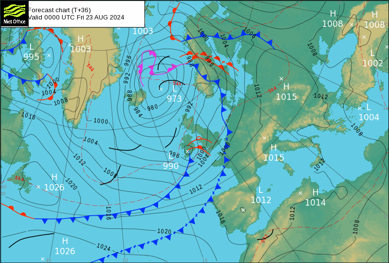
There is quite a large earthquake on the 23rd August 2024, (I was witing for the other shoe to drop after this 7.0M. 102 km E of Petropavlovsk-Kamchatsky, Russia 2024-08-17 @20:10 but it is still resonating 4.8M. 2024-08-24 @00:57) we should know more before then. Etna erupts too. Watch out for this tornado: Low-969 (Or was it the tropical storm Ernesto?)
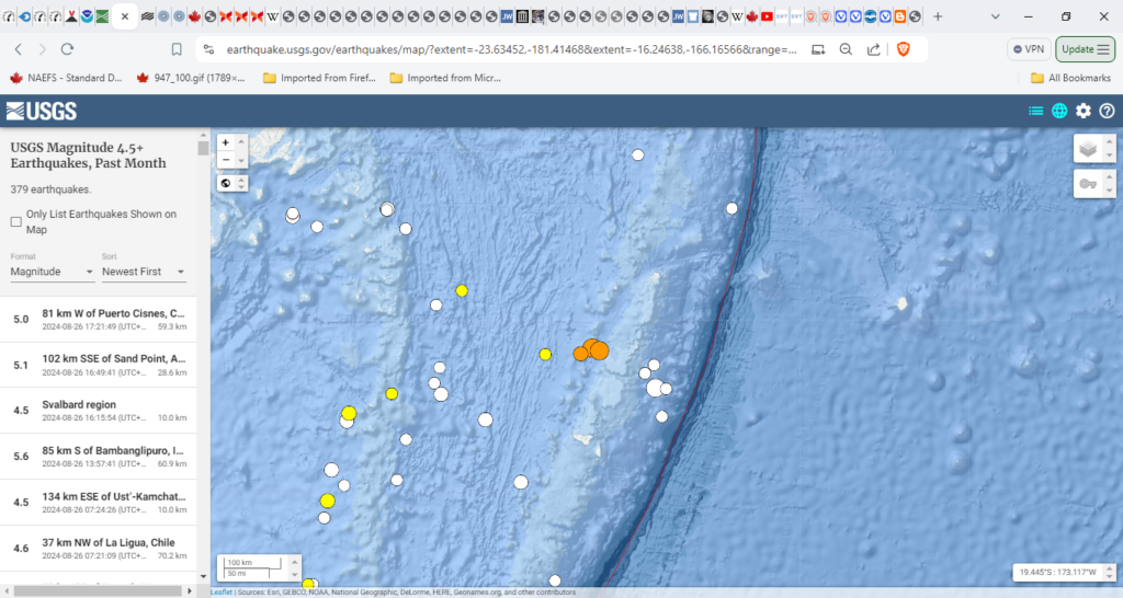
5.3M. 91 km W of Pangai, Tonga 2024-08-26 00:37
6.1M. 59 km W of Pangai, Tonga 2024-08-26 00:30
6.9M. 72 km W of Pangai, Tonga 2024-08-26 00:29
A day late and it should have been a larger quake than the Russian one. Of course I could insist it was a larger quake all three considered.
This is what I was looking at for the forecast. When the planets come out of solution is when the earthquake happens

Fri 2024 Aug 23

Neptune Mercury Sol? Venus.
Jupiter Mars Mercury? Earth
It gets very warm for couple of day before a serious quake. Like today that started out a mild quiet overcast with light drizzle the sure sign of a recent South or Central American erupion. So is this:

Or was it Iceland?
Reports traced Sulphur dioxide to Britain or was it Hydrogen sulphide?
Eruptions to the
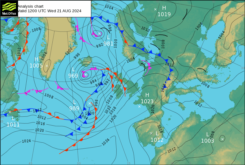
Low to the left of Greenland tend to be Russian and Alaskan Volcanoes. They are always Lows. The Greenland High is Semeru and all the Asian ones, apart from Russia, register as Highs.
L-937 next to Iceland is the combination of the output of three volcanoes described above. It matches Leviathon in that under heaven nobody but Jehovah has control over it. Canaanites today barter for tornadoes in that the land of people whose harvests fall in ruin due to the weather, get to watch billgates buying their farms at a discount.
The body of the Low has expanded as it would in the weather computers, which are not tuned to how the thread of these things are filled with two different types of water: Salty brine from tropical storms and ultra refined pure water from volcanoes. Jehovah calls them tubes of copper.
But that is when the tornado signal appears:

I don’t think god blinds people to these things but he isn’t giving them insight either, is he. Two of the three volcanoes are separate entities as the planets realign, the third one is the one with the tee-shaped fronts tornado signal. Sometimes it looks like a “tee” sometimes like a jellyfish, this one looks like drawn longbow. They all mean North America. (Unless it crosses the Mid Atlantic Ridge.) Maybe I should explain the meteorology initially only shows the initial cyclone before it ages and grows clearer er errr?
The planets start to align, it gets warmer and the earth snaps
Volcanoes get interesting and it gets colder
Cold fronts reach the continent of Europe and break, the earthquakes more violently than the last big one as the Gates of Heaven slam closed. This far your proud waves may come https://biblehub.com/job/38-11.htm still applies.
One last point on this last quake: Parallel Fronts indicate Swarms.


